

Plenty Of Storms Across The Northern Half Of The State At Midday
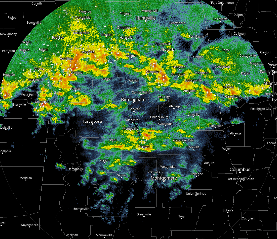
Radar as of 12:44 pm: Showers and heavier thunderstorms continue to move across much of North and the northern parts of Central Alabama, and as we have continued through the morning and now into the beginning of the afternoon, the lightning has really been on the increase throughout the area.
While none of these storm are particularly strong at the moment, some of these are putting down a good bit of rain. What makes this even more amazing is that we are having active lightning in locations where the temperatures are still in the mid-30s.
Temperatures across North and Central Alabama are in the mid-30s to the mid-50s from north to south. Haleyville and Muscle Shoals are currently tied as the cold spots at 36 degrees, while Eufaula is the warm spot at 56 degrees. Huntsville was at 37 degrees, Birmingham was at 41 degrees, and Montgomery was at 50 degrees.
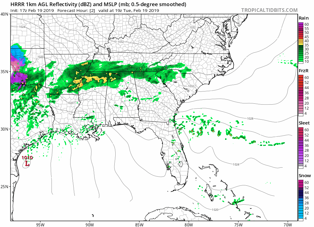
All of this activity will continue to push off to the northeast with the main component of the activity moving out of Central Alabama within the next 2-3 hours, and out of North Alabama within the next 5-7 hours. We’ll still have some scattered showers behind the main activity, but the coverage and rainfall amounts will be much less.
During the late night and overnight hours, scattered showers will continue over much of the area, and where it’s not raining, skies will be cloudy. Overnight lows will be in the lower 40s to the lower 50s.
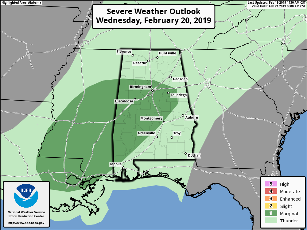
The Storm Prediction Center has defined a good portion of Central Alabama in a Marginal Risk of severe storms on Wednesday. The main threat will be from isolated damaging wind gusts up to 60 MPH, but there is also the potential for a brief tornado or two. Daytime heating along with a warm front moving northward through the area will make surface-based instability values rise. Couple that with sufficient shear, and enough of the ingredients will be there for the threats mentioned above. The threats should remain low because instability values will be on the weaker side. Rain and thunderstorms will be likely north of the I-85 corridor while there will be a good chance of scattered showers and storms south of that. Highs will top out in the upper 50s to the lower 70s from north to south across Central Alabama.

Areal Flood Watch continues for North Alabama through 6:00 pm Friday for Colbert, Cullman, DeKalb, Franklin, Jackson, Lauderdale, Lawrence, Limestone, Madison, Marshall, and Morgan counties.
Areal Flood Watch continues for parts of Central Alabama through 6:00 am Friday for Bibb, Blount, Calhoun, Cherokee, Clay, Cleburne, Etowah, Fayette, Jefferson, Lamar, Marion, Pickens, Shelby, St. Clair, Talladega, Tuscaloosa, Walker, and Winston counties.
Category: Alabama's Weather, ALL POSTS
About the Author (Author Profile)
Scott Martin is an operational meteorologist, professional graphic artist, musician, husband, and father. Not only is Scott a member of the National Weather Association, but he is also the Central Alabama Chapter of the NWA president. Scott is also the co-founder of Racecast Weather, which provides forecasts for many racing series across the USA. He also supplies forecasts for the BassMaster Elite Series events including the BassMaster Classic.Subscribe
If you enjoyed this article, subscribe to receive more just like it.


