

While Severe Threat Lessens, Strong Storms Continue In North/Central Alabama
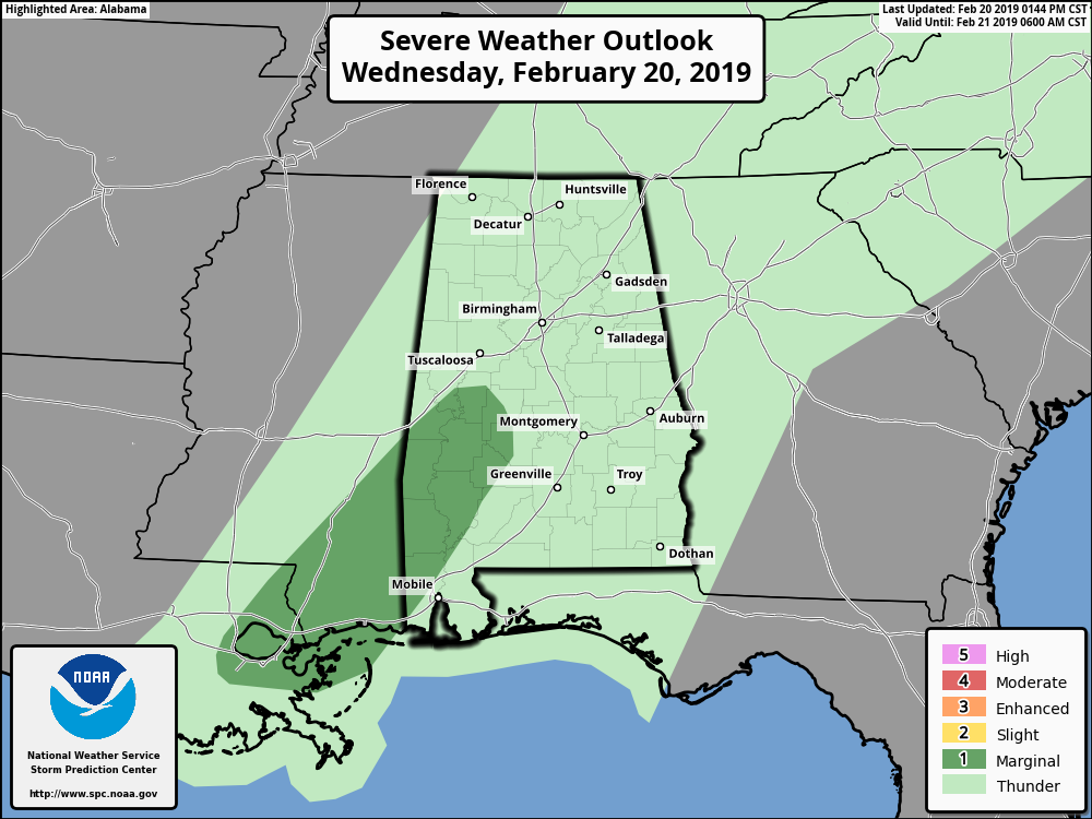
The latest Day 1 Severe Weather Outlook from the Storm Prediction Center shows that the Slight Risk for severe storms for the southwestern parts of Central Alabama has been removed and replaced with a Marginal Risk. The previous Marginal Risk for the west and southwestern parts of the area has been removed.
The reason for this is the instability and the dewpoints have been slower to rise in those locations with the warm air advection out ahead of the cold front. That advection is along and behind a warm front has continued to be held in the extreme southwestern parts of the state, mainly over Mobile and Baldwin counties.
While a few strong to marginally severe storms capable of producing isolated damaging wind gusts up to 60 MPH are possible, the risk has been lowered due to the threat of hail and tornadoes have been removed.
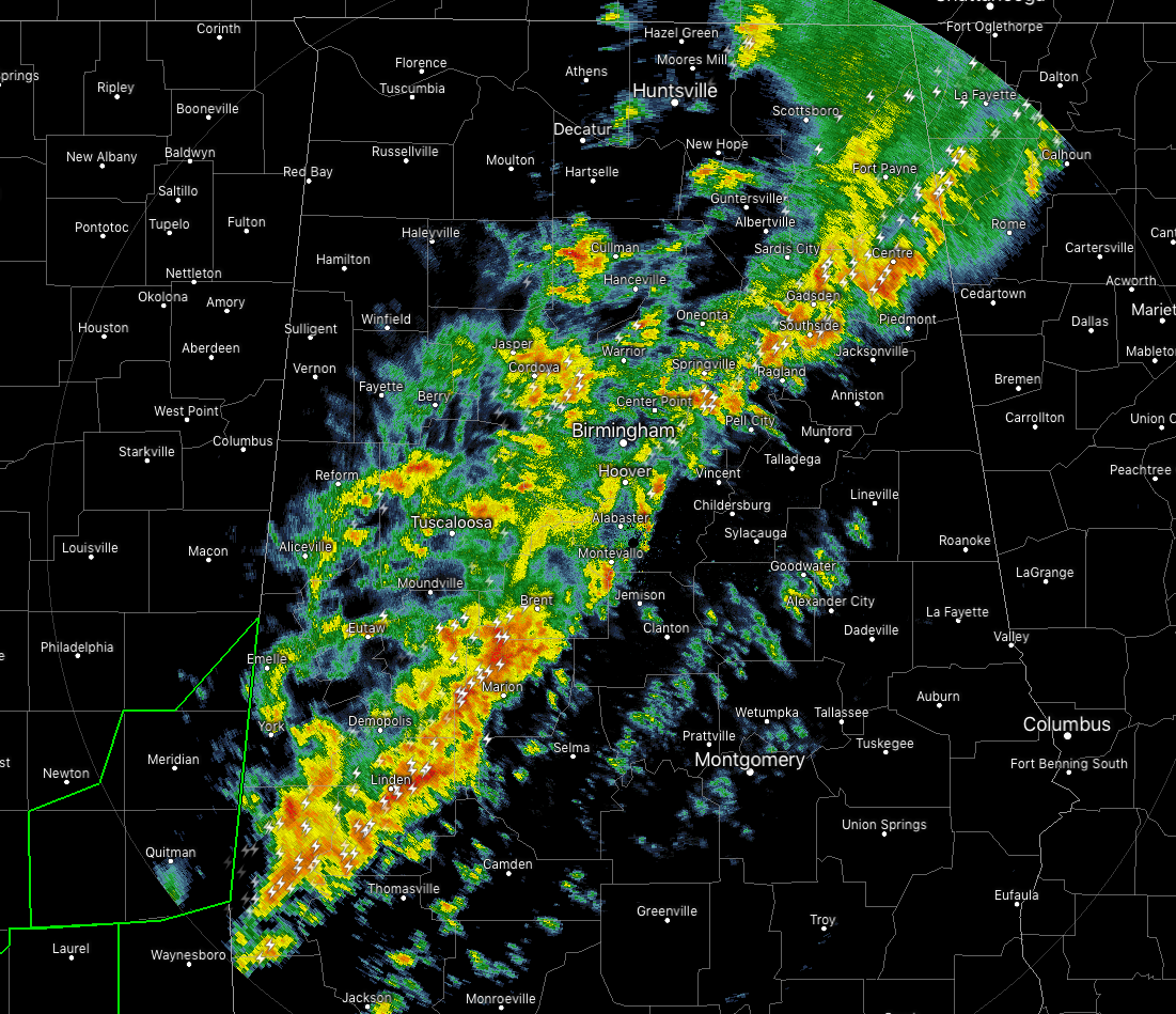
Radar at 1:53 pm continues to show a line of thunderstorms moving slowly eastward across North/Central Alabama. It has been a little while since the last significant weather advisory has been issued on a stronger storm, and better yet, no severe thunderstorm or tornado warnings have been issued today.
Cells within the line of storms are moving off to the northeast rather quickly… as high as 70 MPH in the northern part of the line, to around 40-50 MPH in the southern part.
The latest complete run of the HRRR shows the line of storms diminishing in activity somewhat throughout the evening and late night hours, but it stalls out over the southern parts of the area during the overnight hours, keeping shower chances elevated. Ridging will start to build over the eastern half of the country on Thursday and that will force the line and associated front northward, bringing rain and a few embedded thunderstorms back across the area.
At this point, there is not a defined risk of severe storms anywhere in Central Alabama on Thursday, but a few strong storms are possible over the southeastern parts of the area south of the warm front. The main risks with the stronger storms will be from gusty winds and small hail.
Category: Alabama's Weather, ALL POSTS, Severe Weather
About the Author (Author Profile)
Scott Martin is an operational meteorologist, professional graphic artist, musician, husband, and father. Not only is Scott a member of the National Weather Association, but he is also the Central Alabama Chapter of the NWA president. Scott is also the co-founder of Racecast Weather, which provides forecasts for many racing series across the USA. He also supplies forecasts for the BassMaster Elite Series events including the BassMaster Classic.Subscribe
If you enjoyed this article, subscribe to receive more just like it.


