Rain Falling Once Again In North/Central Alabama At Midday
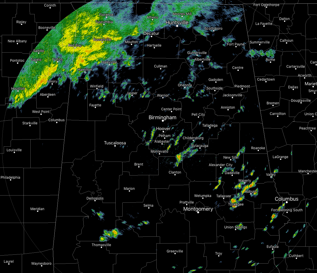
CONDITIONS AT 11:30 AM
We have some scattered shower activity over the southern parts of Central Alabama, but the coverage of those are not that great at the moment. The more organized showers with some heavier rain are located over the extreme northwestern parts of Central Alabama and up into North Alabama. All of this activity is pushing off to the northeast. There is a wide range of temperatures across the area, as readings are coming in from the mid-40s in the northwestern parts of Central Alabama to the upper 70s in the southeast. Troy is the warm spot at 79 degrees while Haleyville is the cool spot at 45 degrees. Birmingham was at 59 degrees.
WEATHER FOR THE REST OF YOUR THURSDAY
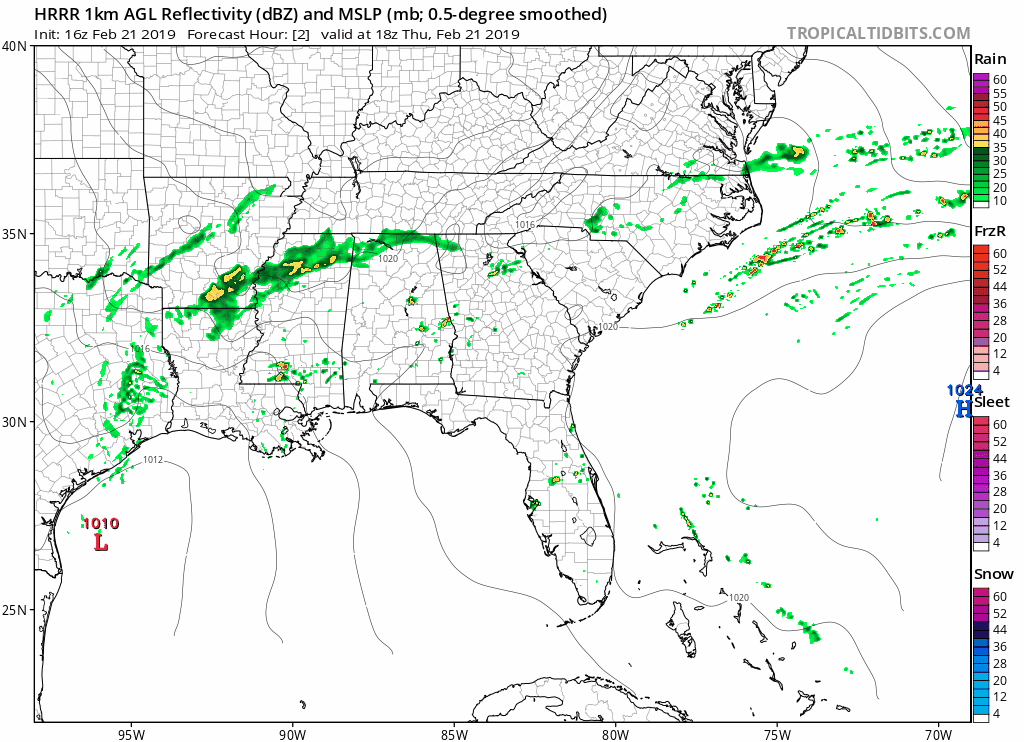
We’ll continue to have scattered to numerous showers and maybe a few thunderstorms across North/Central Alabama throughout the rest of the afternoon and into the early evening hours. Coverage will be greatest north of the I-20 corridor where rain will be likely, while the rest of the area will have a good chance of getting rain. The above animation is the simulated radar valid from noon today through midnight tonight from the latest HRRR run. The good news is that none of the activity is expected to become strong or severe. Afternoon highs will be in the lower 50s to the lower 60s along and north of the I-20 corridor and in the mid-60s to the upper 70s south of that. Scattered to numerous showers will remain likely throughout much of Central Alabama (especially for the northern half) during the late night and overnight hours with a few rumbles of thunder possible. Lows will be in the upper 40s to the mid-60s across the area from northwest to southeast.
UNSETTLED WEATHER CONTINUES INTO FRIDAY
Showers with a couple of thunderstorms mixed in will be likely once again over the northern portions of the area, especially north of the I-59 corridor. Those rain chances diminish somewhat south of the I-59 corridor but still be in the 30%-50% range from southeast to northwest. Temperatures will be much warmer with highs topping out in the mid-60s to the lower 80s across the area from northwest to southeast.
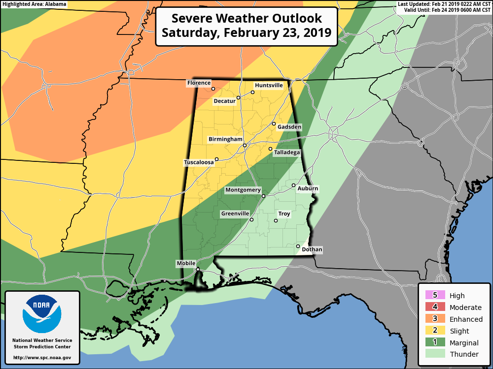
HEADS UP: POTENTIAL FOR SEVERE WEATHER ON SATURDAY
Well, I was hoping for some much brighter and drier weather for my 42nd birthday, but apparently, Mother Nature has different plans. The Storm Prediction Center has a good portion of Central Alabama defined in a Slight Risk for severe storms on Saturday, while nearly the rest of the area defined in a Marginal Risk. The northwest corner of North Alabama has been defined in an Enhanced Risk for severe storms. Main threats will be from damaging thunderstorm wind gusts in excess of 60 MPH, hail of 1 inch in diameter or larger, and a few tornadoes. The main window for severe storms looks to be from 4:00 pm on Saturday afternoon through midnight, starting in the northwest and moving southeast. Now is a good time to go ahead and be prepared for the event. Be sure to go back and read over the Severe Weather Awareness posts that I’ve put up this week. We’ll keep you posted on any updates on Saturday.
BEACH FORECAST CENTER
Get the latest weather and rip current forecasts for the beaches from Fort Morgan to Panama City on our Beach Forecast Center page. There, you can select the forecast of the region that you are interested in.
CONNECT WITH THE BLOG ON SOCIAL MEDIA
You can find the AlabamaWx Weather Blog on the major social media networks:
Facebook
Twitter
Category: Alabama's Weather, ALL POSTS
About the Author (Author Profile)
Scott Martin is an operational meteorologist, professional graphic artist, musician, husband, and father. Not only is Scott a member of the National Weather Association, but he is also the Central Alabama Chapter of the NWA president. Scott is also the co-founder of Racecast Weather, which provides forecasts for many racing series across the USA. He also supplies forecasts for the BassMaster Elite Series events including the BassMaster Classic.Subscribe
If you enjoyed this article, subscribe to receive more just like it.


