Main Line Of Storms Now Moving Into West Alabama
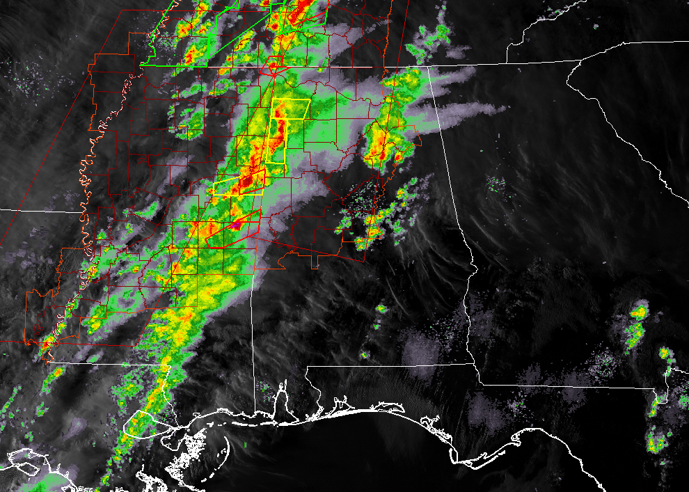
At 5:10 pm, the main line of storms just ahead of the cold front is now making its way into the western parts of North/Central Alabama. We have 1 tornado warning in effect for the extreme northwestern corner of Lauderdale County that will expire at 5:30 pm. We also have two severe thunderstorm warnings in effect for parts of Lamar, Marion, and Franklin counties.
There are two cells with tornado warnings currently in effect on them in eastern Mississippi. We’ll have to see if NWS Birmingham will continue the warnings or go with something else.
So far, no damage has been reported with any of these storms.
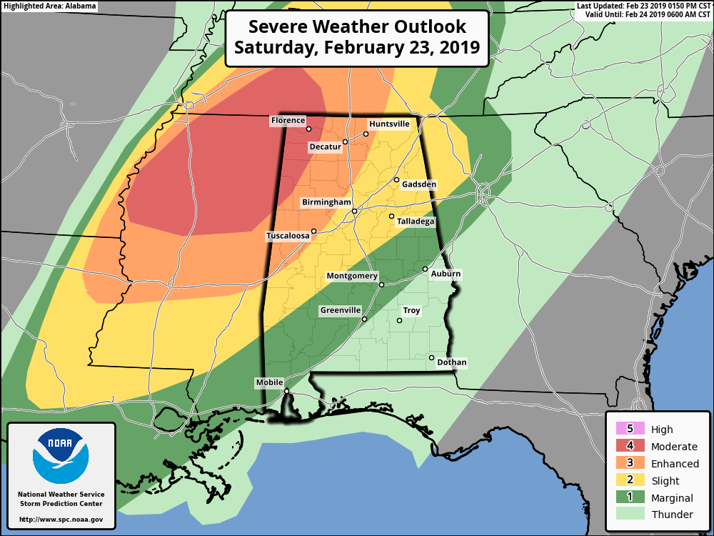
SPC continues a MODERATE RISK of severe storms for parts of North/Central Alabama west of a line stretching from Vernon (Lamar Co.) to Phil Campbell (Franklin Co.) to Lexington (Lauderdale Co.).
An ENHANCED RISK of severe storms continues for parts of North/Central Alabama extending east from the moderate risk to west of a line stretching from Cuba (Sumter Co.) to Northport (Tuscaloosa Co.) to Restone Arsenal (Madison Co.).
A SLIGHT RISK of severe storms continues for parts of North/Central Alabama extending east from the enhanced risk to west of a line stretching from Sweet Water (Marengo Co.) to Clanton (Chilton Co.) to Ranburne (Cleburne Co.).
A MARGINAL RISK of severe storms continues for parts of North/Central Alabama extending east from the slight risk to west of a line stretching from Fort Deposit (Lowndes Co.) to Tallassee (Elmore Co.) to Waverly (Chambers Co.).
At this point, the window for stronger to severe storms will be now through 10:00 pm for locations mainly in the moderate and enhanced risk areas, 8:00 pm – 1:00 am for locations mainly in the slight risk area, and 11:00 pm – 3:00 am for locations mainly in the marginal risk area. Severe storms are not expected in the southeastern parts of the area as the line will have lost its dynamic support and the atmosphere will be more stable.
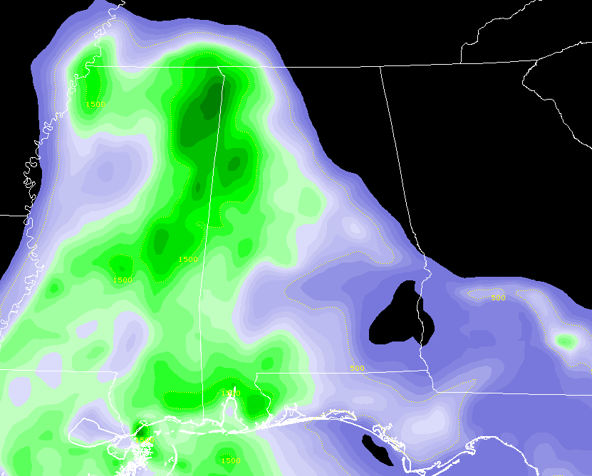
Instability continues to climb over the western and central parts of North/Central Alabama south of the warm front as warmer and more unstable air continues to be advected in from the south. Helicity continues to climb as well, making it easier for these cells to start to rotate and spin tighter.
Significant Tornado Parameter values are now over 3.0 along the Mississippi state line, with a good part of north and west Alabama with values over 1.0 and 2.0.
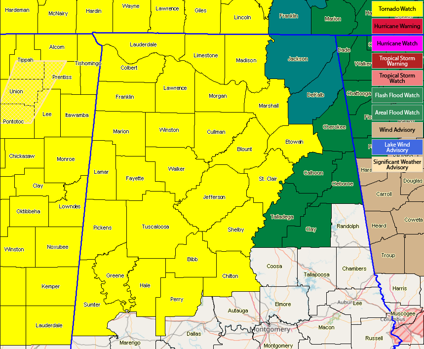
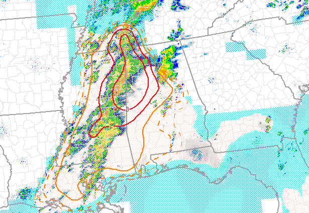
A Tornado Watch remains in effect for the western 2/3rds of North/Central Alabama until 10:00 pm tonight. We’ll continue to keep you posted.
Category: Alabama's Weather, ALL POSTS, Severe Weather
About the Author (Author Profile)
Scott Martin is an operational meteorologist, professional graphic artist, musician, husband, and father. Not only is Scott a member of the National Weather Association, but he is also the Central Alabama Chapter of the NWA president. Scott is also the co-founder of Racecast Weather, which provides forecasts for many racing series across the USA. He also supplies forecasts for the BassMaster Elite Series events including the BassMaster Classic.Subscribe
If you enjoyed this article, subscribe to receive more just like it.


