10:45 p.m. Look at Alabama’s Weather
Thanks for sticking with us all day here on the AlabamaWX Weather Blog.
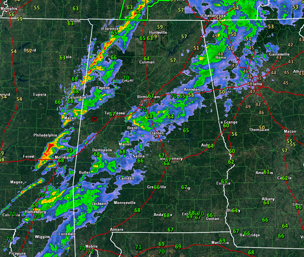
Alabama has dodged a bullet severe weather-wise on this Saturday. Just across the border, our friends in Columbus, Mississippi were not so lucky. The downtown area was impacted by a tornado that caused significant damage just after 5 p.m.
The cold front that will put an end to a week of excessively heavy rain is now lined up from east of Columbus MS to near Haleyville. Dewpoints fall pretty quickly behind the front.
Thunderstorms are lined up along the front and in a line from Pickens through Fayette into Walker County.
No further severe weather is expected, but we can’t rule out a couple of isolated wind damage reports until the storms pass.
The line will reach Tuscaloosa before 11:30 p.m. and Birmingham before 12:30 a.m. It should reach Aniston before 2 a.m. It should continue to weaken as it pushes east.
The flash flood watch for the Tennessee Valley will expire at midnight. The one for Central Alabama will expire at 6 a.m.
Skies will begin to clear toward morning and should be completely clear by lunch time. High temperatures by mid-afternoon will be in the lower 60s. Lows tomorrow night will be range from
Category: Alabama's Weather, ALL POSTS, Severe Weather
About the Author (Author Profile)
Bill Murray is the President of The Weather Factory. He is the site's official weather historian and a weekend forecaster. He also anchors the site's severe weather coverage. Bill Murray is the proud holder of National Weather Association Digital Seal #0001 @wxhistorianSubscribe
If you enjoyed this article, subscribe to receive more just like it.


