

Cold Front Passing Through Causing A Wide Range Of Temperatures At Midday
CONDITIONS AT 12:35 PM
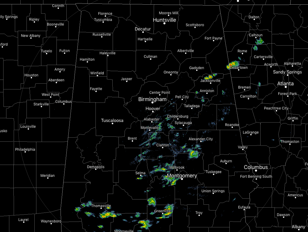
For locations north of the I-59 corridor, we have dry weather with mainly cloudy skies. There are a few breaks out there allowing for a very little amount of sunshine through, but it’s not that much at the moment. South of I-59, we see a few scattered showers along and ahead of a weaker cold front that is pushing through Central Alabama. None of these showers are producing any lightning and they are rather light in most cases. Some do feature some moderate rainfall but those won’t last long as they move nicely off to the east.
We have a wide range in temperatures across the area due to that cold front, ranging from the mid-40s to the lower 70s. Birmingham was at 61 degrees, while it was much cooler in Haleyville at 46 degrees. It is a full 25 degrees warmer down in Eufaula with a reading of 71 degrees being reported.
SHOWER CHANCES CONTINUE THROUGH THE REST OF YOUR FRIDAY

We’ll continue to have a chance of scattered showers mainly across the locations south of the I-59 corridor. North of that, rain will be finished for a little while, at least until after midnight when a few spotty to scattered showers are possible across all of Central Alabama. Skies will continue to be generally cloudy and highs will top out in the lower 50s to the lower 70s across the area from northwest to southeast. Overnight lows will be in the lower 40s to the upper 50s.
SHOWER CHANCES CONTINUE FOR THE SOUTHERN PORTIONS ON SATURDAY

The cold front that has been over Central Alabama today will have finally pushed to the south of the area and will be close to the Gulf Coast by Saturday morning. There will be a very small chance of a few showers mainly for locations south of a line from Tuscaloosa to Alabaster to Anniston while conditions should stay dry through the daylight hours to the north of that. Rain chances will be a little higher south of the I-85 corridor early as the front continues to push farther away. Afternoon highs will top out in the lower 60s to the mid-70s from northwest to southeast underneath mostly cloudy skies. The next storm system starts to push in here around midnight with showers and storms becoming likely in the northwest at first and spreading southeastward throughout the overnight hours. Lows will be in the mid-40s to the upper 50s.
POTENTIAL FOR SEVERE STORMS ON SUNDAY

We’ll have an unstable airmass in place in Central Alabama on Sunday, and with a surface low and a cold front moving through, the potential will be there for strong to severe storms across the area. The Storm Prediction Center has a Slight Risk (level 2 of 5) for all locations south of a line from Fayette to Ashville to Heflin. Nearly all locations north of that line have been placed in a Marginal Risk (level 1 of 5) with the exception of the extreme northern parts of Alabama closest to the state line. Main threats will be from damaging thunderstorm wind gusts up to and exceeding 60 MPH and a few tornadoes, with a smaller threat of hail up to 1 inch in diameter.
The window for stronger to severe storms will be from 12:00 pm to 9:00 pm. We could have some flash flooding issues as rainfall amounts could be around 1.50 to 2.00 inches on Sunday as the soil continues to be extremely saturated. River levels should not be affected majorly by the event.
BEACH FORECAST CENTER
Get the latest weather and rip current forecasts for the beaches from Fort Morgan to Panama City on our Beach Forecast Center page. There, you can select the forecast of the region that you are interested in.
CONNECT WITH THE BLOG ON SOCIAL MEDIA
You can find the AlabamaWx Weather Blog on the major social media networks:
Facebook
Twitter
Category: Alabama's Weather, ALL POSTS
About the Author (Author Profile)
Scott Martin is an operational meteorologist, professional graphic artist, musician, husband, and father. Not only is Scott a member of the National Weather Association, but he is also the Central Alabama Chapter of the NWA president. Scott is also the co-founder of Racecast Weather, which provides forecasts for many racing series across the USA. He also supplies forecasts for the BassMaster Elite Series events including the BassMaster Classic.Subscribe
If you enjoyed this article, subscribe to receive more just like it.


