New SPC Day One Outlook Is Out, No Change in Thinking on Today’s Severe Weather
The new Storm Prediction Center has been posted for today.
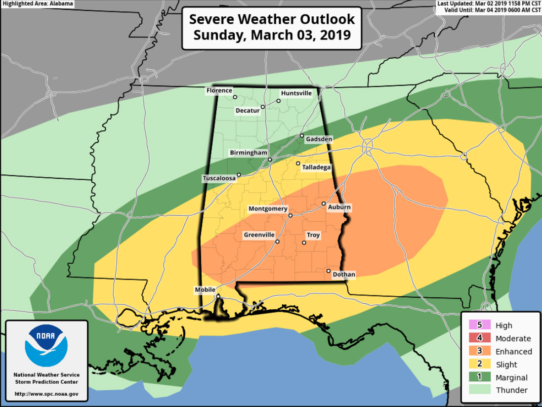
There is a marginal risk (level 1 of 5) for areas generally along I-59, including Tuscaloosa, Birmingham, and Gadsden.
A slight risk (level 2 of 5) covers the remainder of South Alabama and Northwest Florida with an enhanced risk (level 3 of 5) over areas along I-65/I-85 in South Central and South Alabama, including the communities of Jackson, Monroeville, Evergreen, Greenville, Andalusia, Troy, Montgomery Auburn and Dothan.
DAmaging winds will be the main threat, along a few tornadoes are possible, especially in the enhanced risk area. A couple of strong tornadoes are possible across South and eastern Alabama into western Georgia.
I will have more on the severe weather threat, a soaking rain for today, more rain in the future, and a sharp change to colder starting tonight on the Weather Xtreme Video, which will be posted by 7 a.m.
Category: Alabama's Weather, ALL POSTS, Severe Weather
About the Author (Author Profile)
Bill Murray is the President of The Weather Factory. He is the site's official weather historian and a weekend forecaster. He also anchors the site's severe weather coverage. Bill Murray is the proud holder of National Weather Association Digital Seal #0001 @wxhistorianSubscribe
If you enjoyed this article, subscribe to receive more just like it.


