Update on the Alabama Weather Situation at 10:30 a.m.
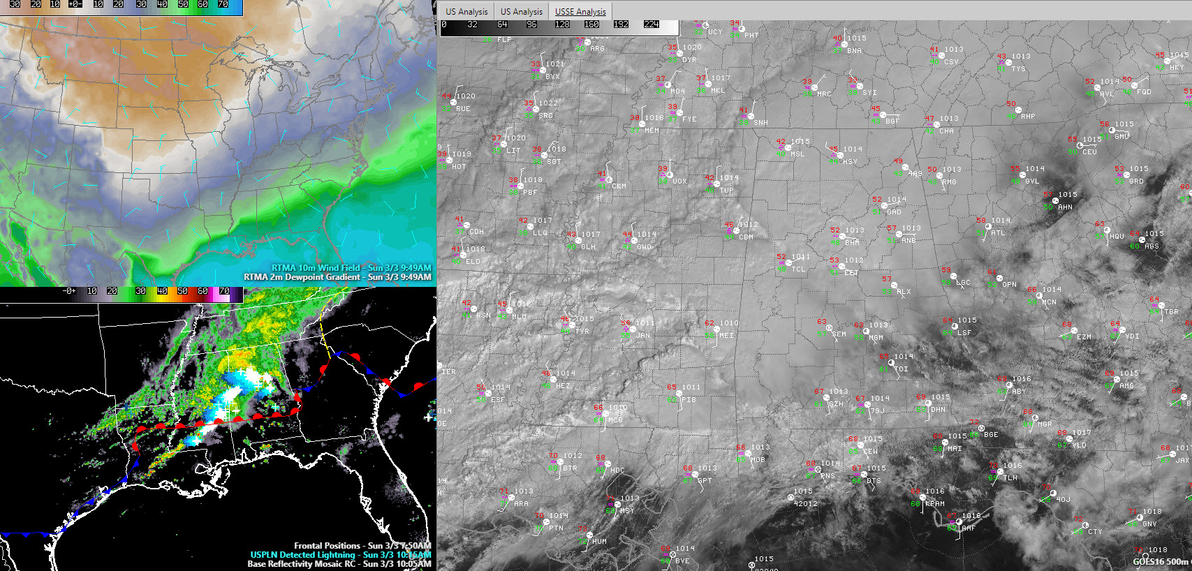
The airmass over South Alabama is beginning to destabilize this morning in the warm sector of a surface low that is west of Meridian.
To the north of US-80 from Demopolis to Selma to Montgomery, clouds and rain are keeping temperatures and instability down.
But as the surface low moves east northeast, deeper moisture and warmth will spread rapidly northeastward. This will result in increasing instability as the low moves eastward. Strong winds at around 10,000 feet are moving in from the west, and this will provide the bulk shear needed for organized storms. This will allow for discrete supercell thunderstorm formation in the warm sector over South Alabama.
A few tornadoes (including a couple of strong ones) will be possible in the warm sector this afternoon across the southern half of Alabama. The best chance for tornadoes will be south of a line from CHatom to Selma to Alex City to Lanett. But, the severe weather threat will extend up as far as North Central Alabama as well, with a slight risk as far north as Tuscaloosa, Birmingham, and Jacksonville. A marginal risk extends up as far a line from Macedonia in Pickens County to Warrior to Gadsden to Centre in Cherokee County.
A tornado watch could be issued soon for parts of South Central and South Alabama.
–
As the cold front pushes eastward this afternoon, a squall line will push into South Central and South Alabama. Damaging winds will be an issue with the line, along with the threat of a few spin-up tornadoes in the line itself. We will be monitoring that carefully.
In addition, rain and storms cover much of North, North Central and West Central Alabama this morning. They are not severe but have lots of lightning and heavy rain. Storms are intensifying over West Alabama Pickens and northern Tuscaloosa Counties. This will spread toward Birmingham eventually, arriving about noon.
Category: Alabama's Weather, ALL POSTS, Severe Weather
About the Author (Author Profile)
Bill Murray is the President of The Weather Factory. He is the site's official weather historian and a weekend forecaster. He also anchors the site's severe weather coverage. Bill Murray is the proud holder of National Weather Association Digital Seal #0001 @wxhistorianSubscribe
If you enjoyed this article, subscribe to receive more just like it.


