One Last Cold Midday Before Warmer Temperatures Arrive On Thursday
CONDITIONS AT 12:50 PM
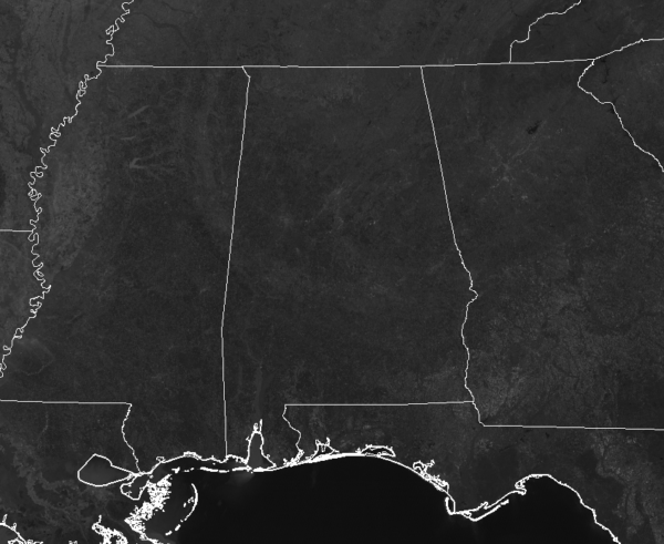
There are a very little amount of small clouds floating over Central Alabama as we are nearing the 1:00 pm hour, but they are very hard to see on the latest satellite image. We can tell very easily that temperatures are still rather cold across the area, with readings in the upper 30s to the upper 40s from north to south. Birmingham was at 43 degrees while the warm spot was Uniontown at 49 degrees. The cold spot is Cullman at 37 degrees.
WEATHER FOR THE REST OF YOUR WEDNESDAY
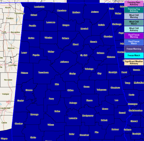
While we’ll remain cold for the remainder of today and through the overnight hours, those high temperatures will be much warmer on Thursday. We’ll continue to have mainly clear skies and afternoon highs will only make it up into the lower 40s to the lower 50s across the area from northwest to southeast. A Freeze Warning continues for all of North and Central Alabama for tonight through the early parts of Thursday morning as skies will be clear and lows in the mid-20s to the lower 30s.
SUNNY & WARMER ON THURSDAY
Skies will be a beautiful cobalt blue filled with plenty of sunshine, especially during the morning and early afternoon hours, before clouds start to move in from the northwest by the late afternoon. Highs will top out in the mid-50s to the lower 60s across the area from north to south. Clouds will continue to build throughout the night but we stay dry. Lows will be in the 40s.
THE POTENTIAL CONTINUES FOR STRONG TO SEVERE STORMS ON SATURDAY
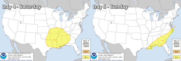
We continue to have the potential for strong to severe storms moving through the area during the afternoon hour on Saturday and not ending until the morning hours on Sunday. As the higher-resolution models continue to come into view for this weekend, we’ll get a better idea on timing and specifics on the exact threat. We do know at this point that all modes of severe weather will be possible at this point (tornadoes, damaging winds, and large hail). For now, timing of the severe storms will be from 3:00 pm CT Saturday through 9:00 am CT Sunday.
Folks, please have your Wireless Emergency Alerts (WEAs) activated on your smartphones and fresh batteries put into your NOAA WeatherRadio and flashlights. We are now in the Spring Severe Weather Season in Alabama, so you have to be prepared for the risk of severe weather with each system that moves through. Have those emergency kits ready to go in case your location comes under a warning. We’ll keep you updated through the week on this developing situation.
CONNECT WITH THE BLOG ON SOCIAL MEDIA
You can find the AlabamaWx Weather Blog on the major social media networks:
Facebook
Twitter
Category: Alabama's Weather, ALL POSTS
About the Author (Author Profile)
Scott Martin is an operational meteorologist, professional graphic artist, musician, husband, and father. Not only is Scott a member of the National Weather Association, but he is also the Central Alabama Chapter of the NWA president. Scott is also the co-founder of Racecast Weather, which provides forecasts for many racing series across the USA. He also supplies forecasts for the BassMaster Elite Series events including the BassMaster Classic.Subscribe
If you enjoyed this article, subscribe to receive more just like it.


