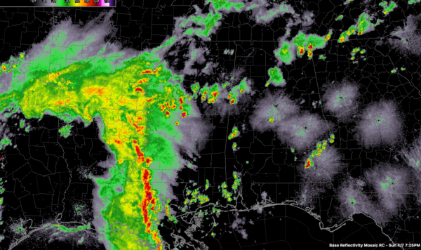
The Latest on Alabama’s Weather at 7:30 p.m.
Scattered storms continue across eastern Mississippi and the northern half of Alabama this evening.
The strongest atthis hour is over Pickens County, near Pickensville.
Another is east of Millport in Lamar County moving toward Fayette.
The earlier severe warned storm over Walker County has weakened and now extends from near Sumiton up to near Smoke Rise and then across Cullman County, but it has diminished to a large patch of mostly light to moderate rain.
Over North Alabama, strong storms are over Jackson County. They will be moving into southern Tennessee soon. A weakening storm was near Huntsville.
In eastern Mississippi, the strongest storm was near Starkville. Another storm was approaching Columbus. These are part of a broken line of strong storms that extend all the way back into the Mississippi Delta near Belzoni and Yazoo City. They are intensifying ahead of a strong upper level disturbance and mesoscale convective system that is pushing east tonight. Strong storms and widespread heavy rain cover much of southeastern Louisiana and southwestern Mississippi at this hour. There is one severe thunderstorm warning across Central Mississippi. This activity will reach Alabama later tonight. If it holds together, and it appears it will, it could produce an isolated severe weather report or two.
More strong to severe storms are possible on Monday across the state as the upper level trough works its way eastward along with a weak surface low.
Category: Alabama's Weather, ALL POSTS


