A Brief Look At Monday’s Severe Storm Threat For Central Alabama
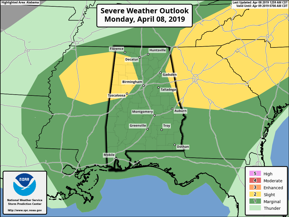
The SPC has two parts of Central Alabama in a Slight Risk for severe storms while the rest of the area is in a Marginal Risk. The first Slight Risk area includes locations west of a line from Tuscaloosa to West Jefferson to just east of Moulton. The second area includes locations east of a line from just east of Valley Head to Leesburg to Heflin to Huguley. All modes of severe weather will be possible throughout the day from roughly 9:00 am to 9:00 pm… tornadoes, large hail, and damaging winds up to 60 MPH.
We’ll have a round of storms push through the area during the pre-dawn hours but more convective storms will develop after sunrise and will mainly be scattered in nature. These storms will have the potential to become strong to severe as we’ll have plenty of instability and decent shear in place to support rotating updrafts. Significant tornado parameter values will be topping out around 4.0 in some locations.
It’s a mixed bag for the timing of the threat of severe storms as we can see the window in the western-third of the area from 9:00 am to 9:00 pm, in the central-third from 12:00 pm to 5:00 pm, and from 2:00 pm to 7:00 pm in the eastern-third.
After starting off in the 60s for the early morning low, highs will climb into the mid to upper 70s. Winds will be out of the south at 5-10 MPH with gusts up to 20 MPH possible at times. When rain is not falling in your location, skies will remain cloudy.
The core of the upper low will move through the area late Monday night and into the overnight hours that will bring another round of showers and storms, but instability will be elevated with these and severe storms are not expected. Overnight lows will be in the upper 50s to the lower 60s.
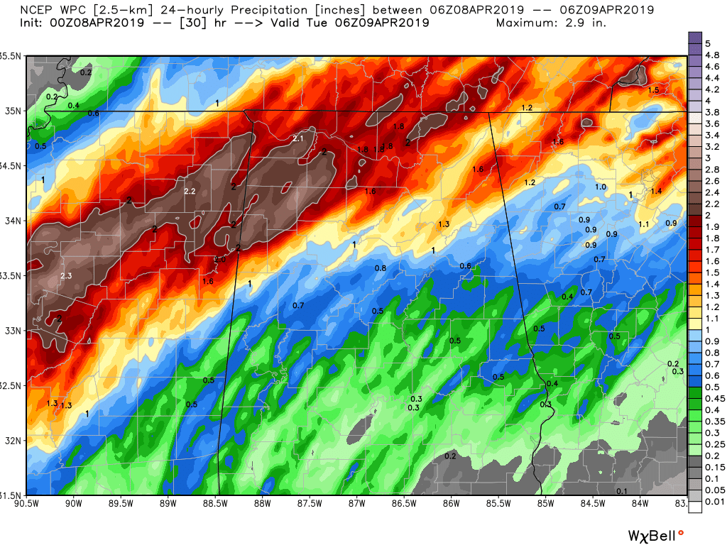
Rainfall amounts will be highest over the northern parts of the state while much of Central Alabama will see around 0.25 inches in the southern parts of the area to as high as 2.00 inches in the northwestern corner of the area.
Have your severe weather safety plan and safety kits ready to go just in case your location goes under a warning. Make sure you have fresh batteries in your NOAA WeatherRadio and flashlights and be sure to have your smartphones fully charged with the ABC 33/40 app so you can watch live tornado coverage in your safe place.
Category: Alabama's Weather, ALL POSTS, Severe Weather
About the Author (Author Profile)
Scott Martin is an operational meteorologist, professional graphic artist, musician, husband, and father. Not only is Scott a member of the National Weather Association, but he is also the Central Alabama Chapter of the NWA president. Scott is also the co-founder of Racecast Weather, which provides forecasts for many racing series across the USA. He also supplies forecasts for the BassMaster Elite Series events including the BassMaster Classic.Subscribe
If you enjoyed this article, subscribe to receive more just like it.


