SPC Shrinks Slight Risk, State Still Susceptible To Severe Storms
There continues to be plenty of cloud cover and rain-cooled air over the north and northeastern parts of the area, but rain-free and mostly sunny conditions are occurring over the west and southwestern parts, and that is where we need to focus our attention for the next several hours.
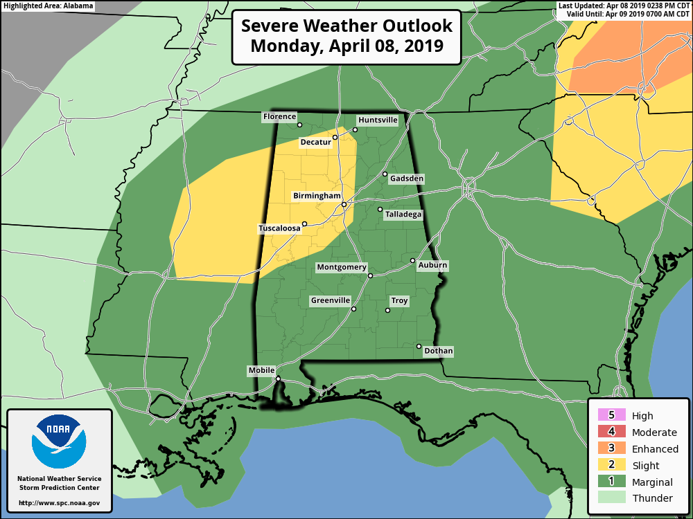
SPC has shrunk the Slight Risk in North/Central Alabama to mainly the northwestern quarter of the state while continuing the Marginal Risk for the remainder of Alabama. The Slight Risk now includes locations west of a line from Cuba to Heiberger to Chelsea to Baileyton to Madison.
The threats will continue to be from damaging winds up to and exceeding 60 MPH, hail up to quarter-size in diameter or larger, and tornadoes.
Timing continues to be from now until 10:00 am on Tuesday morning, with the main window from now until midnight over the western parts of the area, now through 4:00 am Tuesday in the central locations, and from now until 10:00 am in the east.
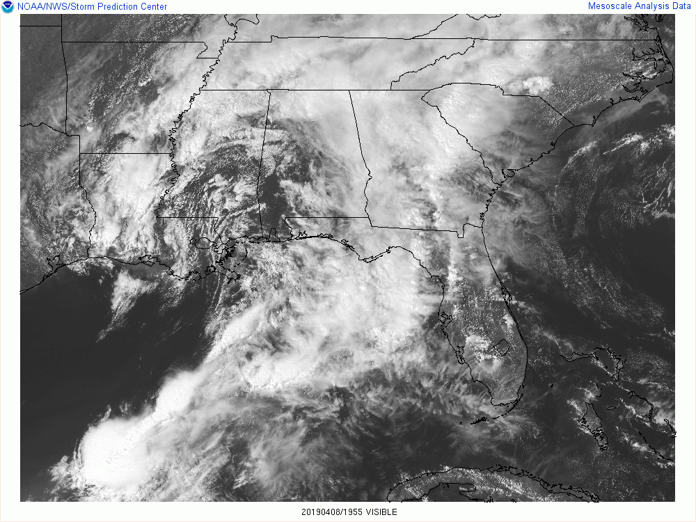
Clouds have broken up and clearing has taken place over the west and southwestern parts of the state, and this is where we will need to watch for the development of strong to severe storms over the next couple of hours.
Instability values over the western parts of the area are now over 2000 J/kg, and with sufficient shear and low-level moisture in place, the potential for strong to severe thunderstorm development is already in place. Temperatures are approaching 80 degrees in the west and southwestern parts of the area, so we should see some thunderstorms develop soon. Latest SPC Hourly Mesoscale Analysis shows no cap in place, so now we wait.
Today is a day we do not need to let our guard down. Even with the Slight Risk area being reduced, be ready just in case your location goes under a warning. Expect the unexpected as this is the prime of our Spring Severe Weather Season, just like this morning with the cells that fired up and spawned two confirmed EF1 tornadoes in the northern parts of the area. We’ll keep you posted on the blog throughout the day.
Category: Alabama's Weather, ALL POSTS, Severe Weather
About the Author (Author Profile)
Scott Martin is an operational meteorologist, professional graphic artist, musician, husband, and father. Not only is Scott a member of the National Weather Association, but he is also the Central Alabama Chapter of the NWA president. Scott is also the co-founder of Racecast Weather, which provides forecasts for many racing series across the USA. He also supplies forecasts for the BassMaster Elite Series events including the BassMaster Classic.Subscribe
If you enjoyed this article, subscribe to receive more just like it.


