The Rush Hour Update On Our Severe Storm Potential

At 4:50 pm, we are now starting to see some showers developing over the southeastern parts of Mississippi and over the southwestern parts of Central Alabama, mainly over the central parts of Sumter County. We also have some scattered showers over the northwestern parts of Central Alabama, mainly over Marion and Winston counties. All of these are roughly moving to the northeast at 25 MPH.
So far, we have stayed rather quiet throughout the afternoon hours, but with the instability values already over 2000 J/kg in parts of the area, I’m pretty positive that we’ll see more storm development shortly.
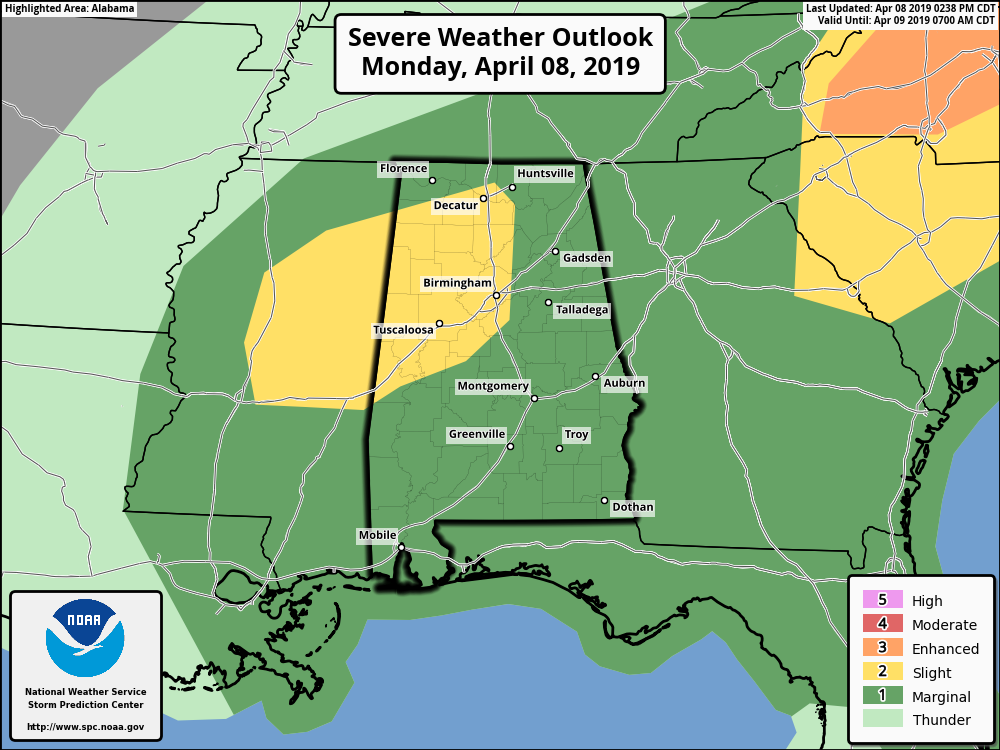
SPC continues a Slight Risk for locations west of a line from Cuba to Heiberger to Chelsea to Baileyton to Madison. A Marginal Risk continues for the rest of the state. Main threats are damaging winds up to 60 MPH and quarter-size hail, but an isolated tornado or two cannot be ruled out for the rest of today and into tonight.
Timing is for the potential for severe storms across the area is from now until 10:00 am Tuesday morning. The window for the potential of severe storms in the northwestern-third is from now until 2:00 am Tuesday, in the central-third from now until 6:00 am, and for the southeastern-third until 10:00 am.
There is the potential for a watch to be issued later today, but as for exactly when and if all depends on the development that we see in the next few hours.
I know it’s been a waiting game but continue to stay weather aware as we have a long time to go before the threat is over for the state. Keep checking back with us.
Category: Alabama's Weather, ALL POSTS, Severe Weather
About the Author (Author Profile)
Scott Martin is an operational meteorologist, professional graphic artist, musician, husband, and father. Not only is Scott a member of the National Weather Association, but he is also the Central Alabama Chapter of the NWA president. Scott is also the co-founder of Racecast Weather, which provides forecasts for many racing series across the USA. He also supplies forecasts for the BassMaster Elite Series events including the BassMaster Classic.Subscribe
If you enjoyed this article, subscribe to receive more just like it.


