Stronger Storms Continuing To Move Into The Northwestern Parts Of The Area
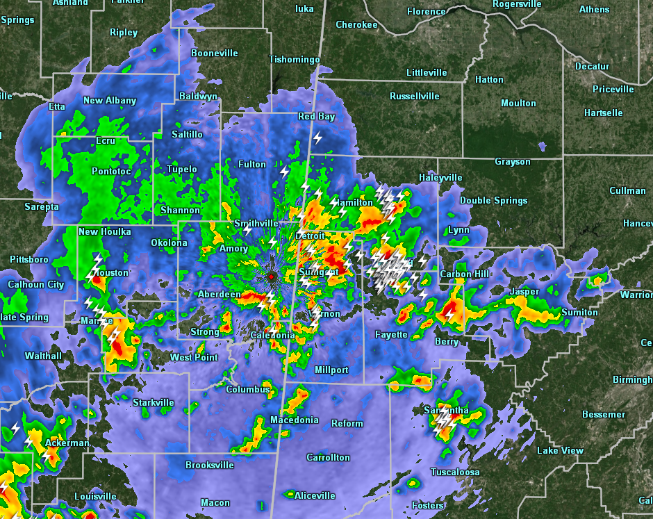
The strongest storms in the state are located over Marion, Lamar, Fayette, and Tuscaloosa counties, but the good news is that there are no current warnings in effect for North/Central Alabama. With that being said, we can expect some gusty wind and some hail with these cells as they move off to the northeast at 25 MPH.
The storms are starting to move into the most unstable airmass across the area but is lacking the shear needed for tornadoes to form, so the main threats from these will be with damaging winds up to 60 MPH and large hail up to quarter-size in diameter.
There are more storms back to the south-southwest back in Mississippi, but none of these are severe at the moment, but we’ll keep our eyes on them throughout the rest of the night and into the overnight hours.
Category: Alabama's Weather, ALL POSTS, Severe Weather
About the Author (Author Profile)
Scott Martin is an operational meteorologist, professional graphic artist, musician, husband, and father. Not only is Scott a member of the National Weather Association, but he is also the Central Alabama Chapter of the NWA president. Scott is also the co-founder of Racecast Weather, which provides forecasts for many racing series across the USA. He also supplies forecasts for the BassMaster Elite Series events including the BassMaster Classic.Subscribe
If you enjoyed this article, subscribe to receive more just like it.


