A Late Night Look At The Continuing Severe Storm Threat

At 11:30 pm, we continue to have scattered showers and thunderstorms over the northwestern quarter of the area with a good bit of lightning showing up in several of these cells. But we have to watch cells in the southeastern parts of the area that are developing. One note from NWS Birmingham stated that there is a small tornado threat over the southeastern corner of the area throughout the late night and overnight hours. There is the potential for a few strong storms in the northwestern parts and as more move over the central parts of the area as well.
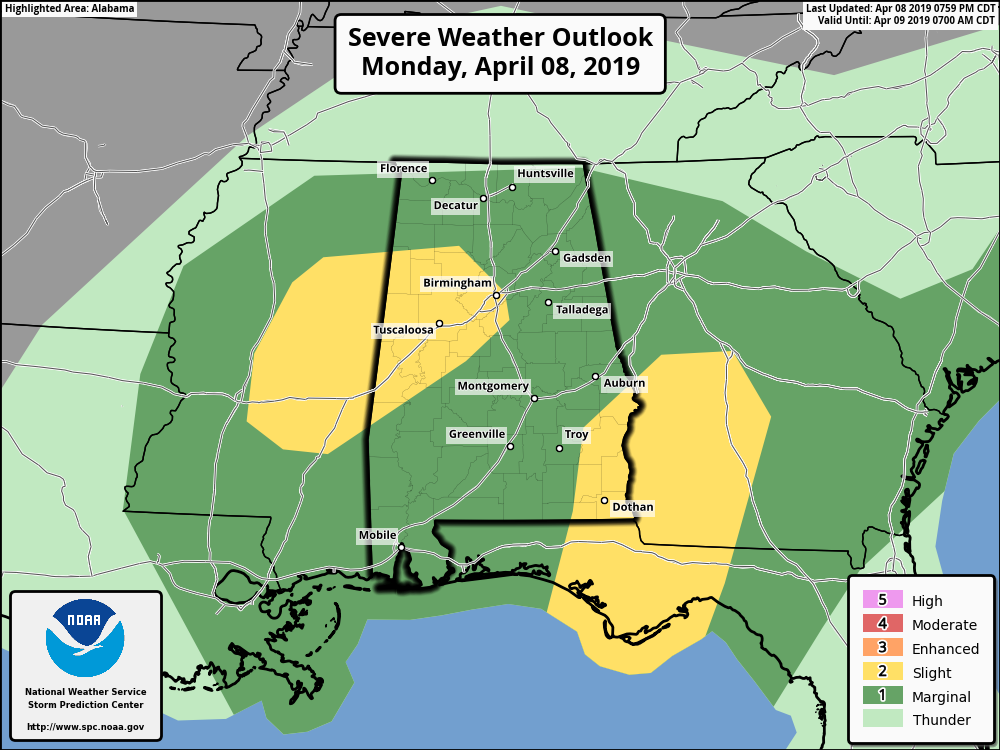
We continue to have two areas defined by the SPC in a Slight Risk for severe storms while nearly the rest of the state is defined in a Marginal Risk. Threats will be from isolated damaging winds up to 60 MPH along with quarter-size hail. the tornado threat is not zero across the area but is mighty low with the exception of a slightly higher risk over the southeastern corner.
The main window of the threat of severe storms has been adjusted from now through 7:00 am, with the threat coming to an end by 1:00 am in the western-third of the area, by 4:00 am in the central parts, and by 7:00 am in the east.
We’ll continue to keep you posted as long as there is a threat of severe storms. Stay tuned.
Category: Alabama's Weather, ALL POSTS, Severe Weather
About the Author (Author Profile)
Scott Martin is an operational meteorologist, professional graphic artist, musician, husband, and father. Not only is Scott a member of the National Weather Association, but he is also the Central Alabama Chapter of the NWA president. Scott is also the co-founder of Racecast Weather, which provides forecasts for many racing series across the USA. He also supplies forecasts for the BassMaster Elite Series events including the BassMaster Classic.Subscribe
If you enjoyed this article, subscribe to receive more just like it.


