A Quick Check On Our Weather At 2:00 PM
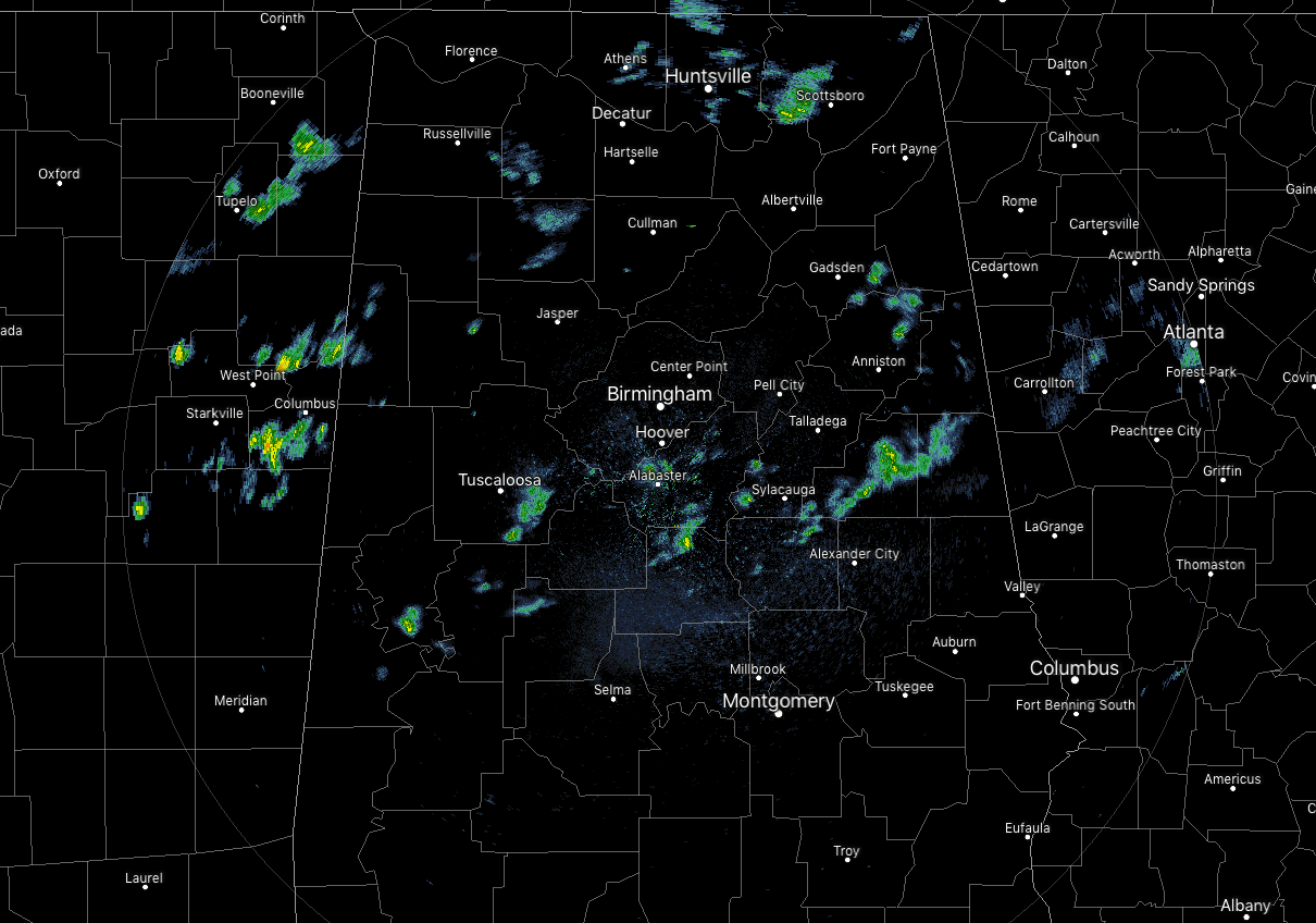
Since the last update a couple of hours ago, the shower activity across North/Central Alabama has really quieted down. Only a few scattered light showers remain across portions of the area, while most of the area is now experiencing some sunshine as we now have a mix of sun and clouds. Temperatures are now in the mid-60s to the mid-80s across the area as the warm front is now starting to move northward and has reached the I-59 corridor.
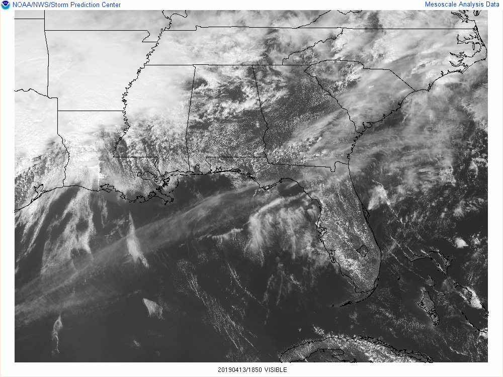
That might be a little worrisome as any extra heating of the atmosphere will allow for even more destabilization. We’ll have to watch for the development of any cells during the late afternoon and early evening hours. If any are able to break through the cap in place, they could go strong to severe and may start to rotate.
No change in the timing and in the threats for the event that is expected to move into the western parts of North/Central Alabama around the midnight hour and continue through the area before exiting for good by 1:00 pm on Sunday afternoon.
Threats continue to be tornadoes and damaging winds up to and exceeding 60 MPH. We do have the possibility for stronger long-track tornadoes (EF2 and above) across all of Central Alabama, but at this point, the higher probability of those will be west of the I-65 corridor. There is a smaller threat of large hail up to one-inch in diameter across the area as well.
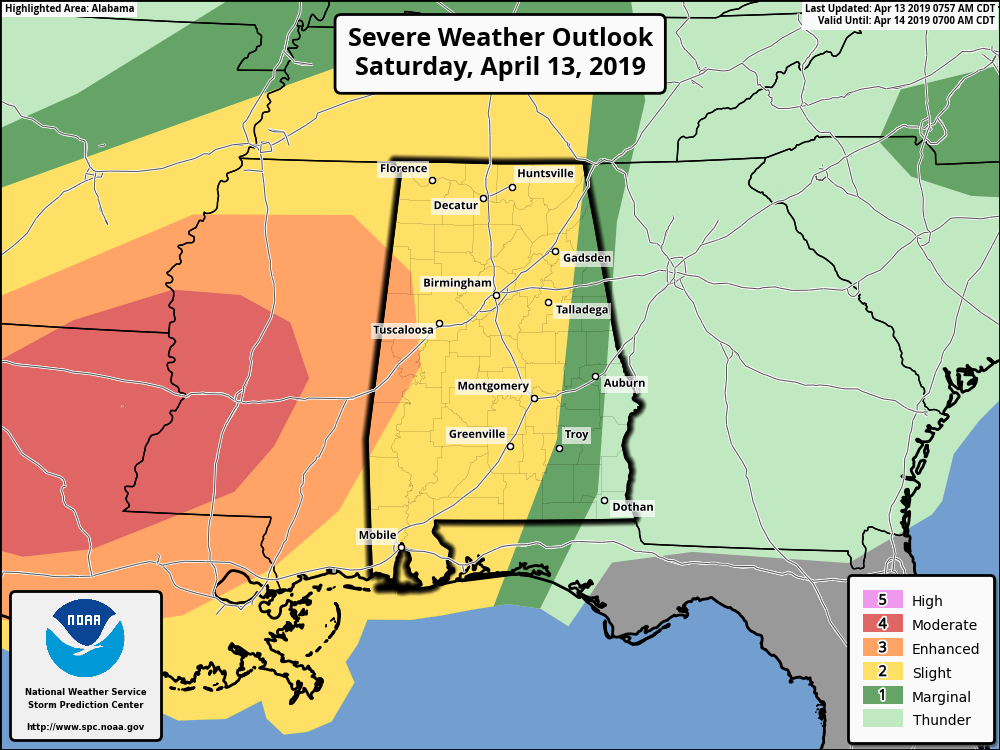
For today (through 7:00 am Sunday), SPC continues an Enhanced Risk is up for locations west of a line from Sulligent to Gordo to Eutaw. A Slight Risk extends out from that to as far east as Fort Payne to Alexander City to Troy. A Marginal Risk is up as far east as Roanoke to Opelika to Blue Springs.
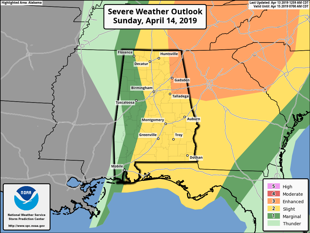
For Sunday (from Sunday 7:00 am to Monday 7:00 am), SPC has an Enhanced Risk up for locations east of a line from Hytop to Rainbow City to Talladega. A Slight Risk is up for locations east of a line from Florence to West Blocton to Orrville. A Marginal Risk is up for nearly the rest of the area except for locations west of a line from Macedonia to Myrtlewood.
We’ll continue to have updates throughout the event on the blog. Remember, any warnings that are issued are instantly posted to the blog. Stay weather aware.
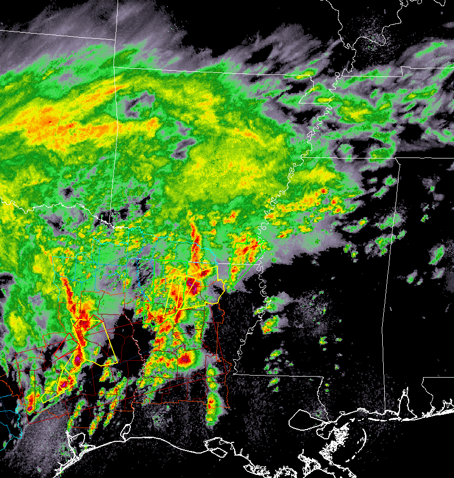
Back to our west, activity has really cranked up with multiple tornado and severe thunderstorm warnings across portions of Texas and Louisiana. We know of some major damage that has occurred in the Franklin community of Texas. I have only seen news of one injury so far and let’s hope it stays that way.
Category: Alabama's Weather, ALL POSTS, Severe Weather
About the Author (Author Profile)
Scott Martin is an operational meteorologist, professional graphic artist, musician, husband, and father. Not only is Scott a member of the National Weather Association, but he is also the Central Alabama Chapter of the NWA president. Scott is also the co-founder of Racecast Weather, which provides forecasts for many racing series across the USA. He also supplies forecasts for the BassMaster Elite Series events including the BassMaster Classic.Subscribe
If you enjoyed this article, subscribe to receive more just like it.


