Very Active Out West; Our Turn Comes After Midnight
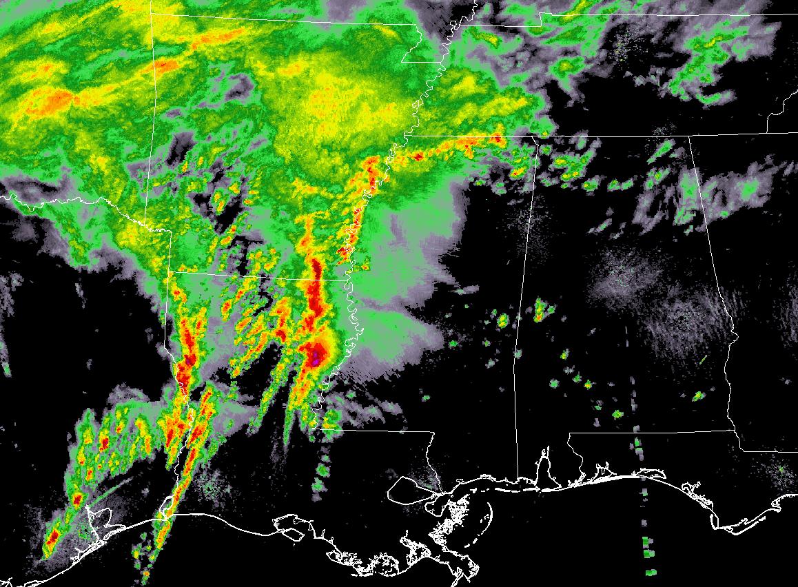
As of 4:00 pm, much of the active storms are over the northern parts of Louisiana and into the southern parts of Arkansas. There are currently 6 severe thunderstorm warnings and 1 tornado warning in effect throughout those locations. Those storms are now beginning to cross over the Mississippi River and enter into the western parts of Mississippi.
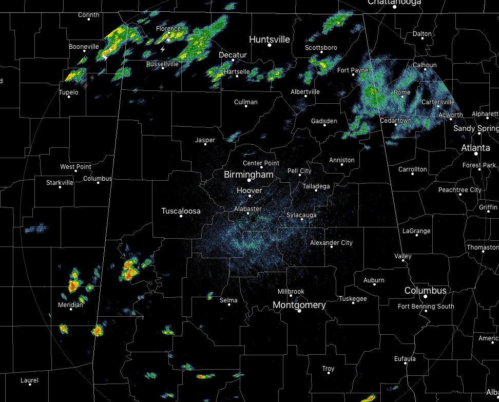
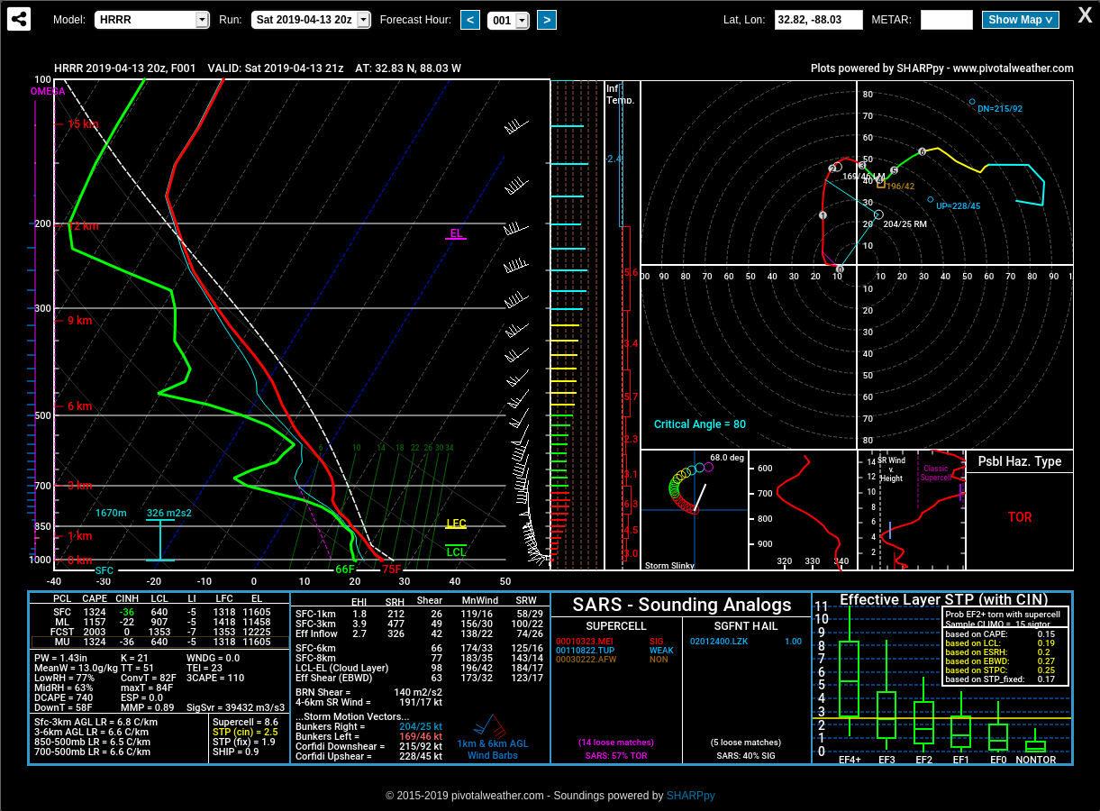
Closer to home, we have some showers and thunderstorms starting to develop over the southwestern parts of Central Alabama while we continue to have showers and a few thunderstorms over the northern parts of North Alabama. We’ll have to keep our eye on those storms in the southwest as instability rates are already in the 1,500-3,000 J/kg range along with decent bulk shear in place. These storms could grow strong and start to rotate. The latest HRRR sounding for that part of the area is already showing conditions prime for tornado development with an STP value of 2.5.
No changes to the forecast, threats, or risk levels. Stay weather aware throughout the rest of the day, through the night, and through the morning hours on Sunday. We’ll have updates throughout the event.
Category: Alabama's Weather, ALL POSTS, Severe Weather
About the Author (Author Profile)
Scott Martin is an operational meteorologist, professional graphic artist, musician, husband, and father. Not only is Scott a member of the National Weather Association, but he is also the Central Alabama Chapter of the NWA president. Scott is also the co-founder of Racecast Weather, which provides forecasts for many racing series across the USA. He also supplies forecasts for the BassMaster Elite Series events including the BassMaster Classic.Subscribe
If you enjoyed this article, subscribe to receive more just like it.


