

Storms Over Central Alabama Not Severe For Now; But Parameters Already Getting In Place

A few storms are over Central Alabama, west of I-65. They are moving north-northeast at 40 mph.
One of the stronger ones is approaching McCalla in southwestern Jefferson County. It will cover territory between North Johns and Bessemer up to Hueytown, Pleasant Grover, and Mulga and Minor.
The other strong storm is crossing former Highway 78 between Winfield and Carbon Hill.
Both storms exhibiting lightning and the possibility of small hail. There will be gusty winds as well.
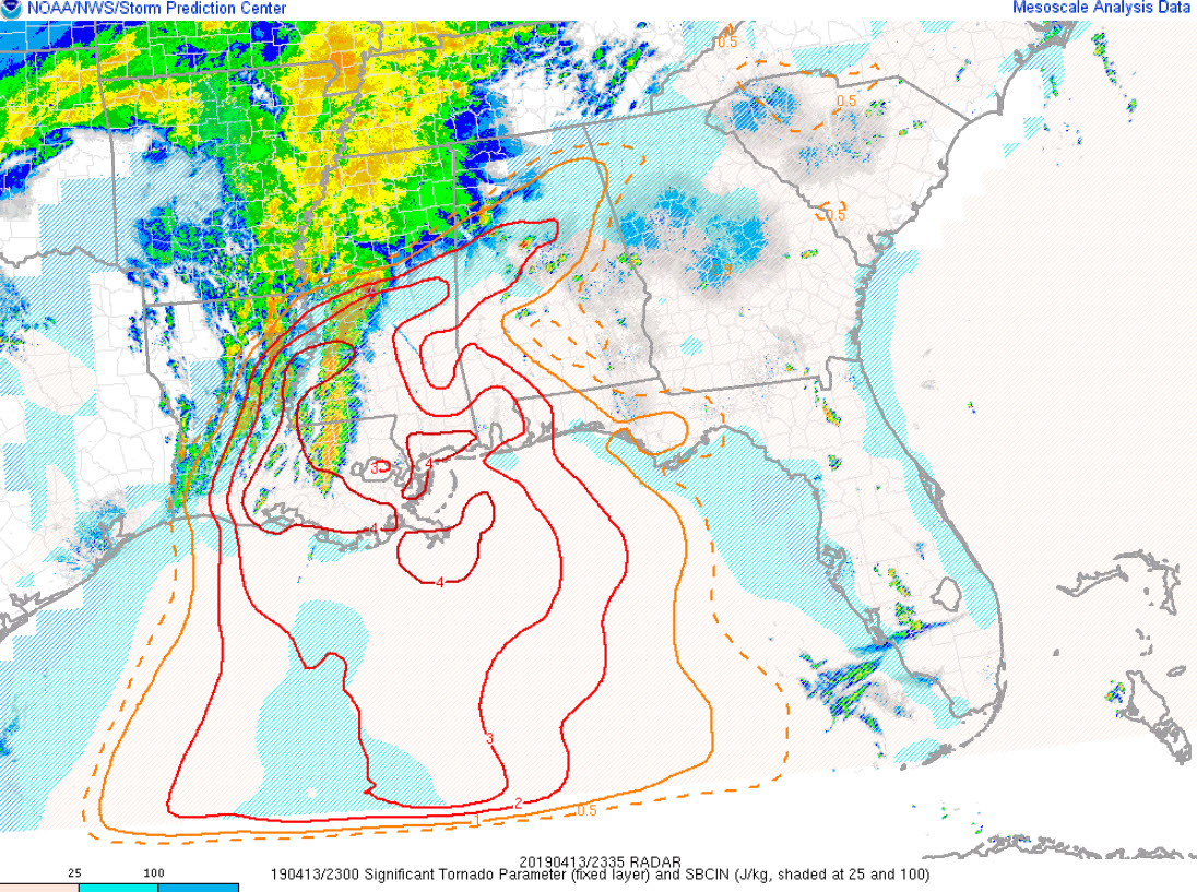
Current Significant Tornado Parameter
Current severe weather parameters over West Central Alabama include:
CAPE values of 500-1500 joules/kg
Increasing bulk shear of 35-70 knots (extreme)
Increasing low level helicities. North of US-82, they are already running over 250 m2/s2/
STP values are already running 1-3, so we will have to watch stronger updrafts already this evening.
Category: Alabama's Weather, ALL POSTS
About the Author (Author Profile)
Bill Murray is the President of The Weather Factory. He is the site's official weather historian and a weekend forecaster. He also anchors the site's severe weather coverage. Bill Murray is the proud holder of National Weather Association Digital Seal #0001 @wxhistorianSubscribe
If you enjoyed this article, subscribe to receive more just like it.


