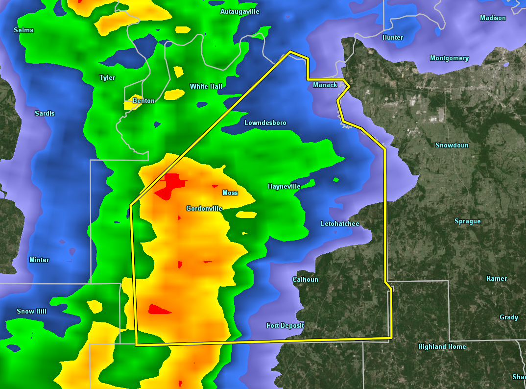
A Severe Thunderstorm Warning Remains In Effect Until 5:30 AM CDT For Eastern Lowndes County

…A SEVERE THUNDERSTORM WARNING REMAINS IN EFFECT UNTIL 530 AM CDT FOR EASTERN LOWNDES COUNTY… At 502 AM CDT, severe thunderstorms were located along a line extending from near Lowndesboro to Lowndes County Airport, moving northeast at 35 mph.
HAZARD…60 mph wind gusts.
SOURCE…Radar indicated.
IMPACT…Expect damage to roofs, siding, and trees. Locations impacted include… Fort Deposit, Mosses, Hayneville, White Hall, Gordonville, Lowndesboro, Lowndes County Airport, Logan, Beechwood, Calhoun, Manack and Letohatchee.
Severe Thunderstorm Warning Issued For Parts Of Lowndes County Until 5:30AM
Apr 14th @ 4:47 am

The National Weather Service in Birmingham has issued a
* Severe Thunderstorm Warning for…
Lowndes County in south central Alabama…
* Until 530 AM CDT.
* At 447 AM CDT, severe thunderstorms were located along a line extending from near Gordonville to 9 miles west of Lowndes County
Airport, moving northeast at 40 mph.
HAZARD…60 mph wind gusts.
SOURCE…Radar indicated.
IMPACT…Expect damage to roofs, siding, and trees.
* Locations impacted include…
Fort Deposit, Mosses, Hayneville, White Hall, Gordonville, Lowndesboro, Lowndes County Airport, Beechwood, Logan, Calhoun, Manack, Letohatchee, Mount Willing, Collirene, Clover Hill and
Fostoria.
Category: ALL POSTS
About the Author (Author Profile)
Subscribe
If you enjoyed this article, subscribe to receive more just like it.


