

A Mid-Afternoon Check On Our Weather, Active Warnings To Our West
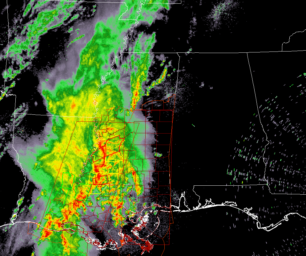
A line of strong to severe storms are moving through the west and southwestern parts of Mississippi and down into the eastern half of Louisiana, which has needed a few Tornado Warnings and Severe Thunderstorm Warnings within the past several minutes. One of those tornado warnings includes the city of Jackson and is set to expire at 2:45 PM.
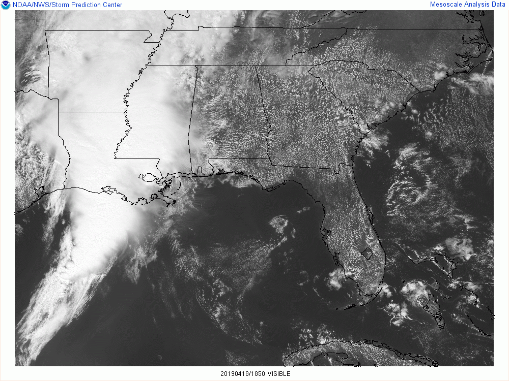
While our neighbors to our west are experiencing rough weather at this time, we have some sunshine breaking through the clouds across Central Alabama which is actually helping to destabilize our atmosphere. Instability values are not that impressive at this point, but it doesn’t take much around here to get severe storms.
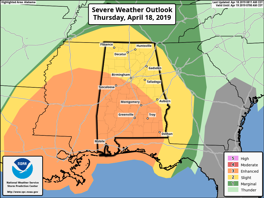
SPC continues an Enhanced Risk for severe storms up for locations south of a line from Vernon to Hoover to just north of Tuskegee for today through 7:00 am Friday. A Slight risk is up for the rest of Central Alabama. Tornadoes and damaging winds will be the main threats with this event, but there is a much smaller risk of large hail up to quarter size.
The main window for severe storms across Central Alabama continues to be from 4:00 pm this afternoon until 5:00 am Friday morning. To break it down, the western third of the area (west of a line from Demopolis to West Jefferson to Holly Pond) will occur from 4:00 pm to 10:00 pm west to east, the central third of the area (east to a line from Fort Deposit to Alexander City to Ranburne) from 7:00 pm to 1:00 am, and the eastern third of the area from 10:00 pm to 5:00 am.
The higher chance of tornadoes continues to look to be in the enhanced risk locations, mainly south of a line stretching from Tuscaloosa to Clanton to Auburn. The Storm Prediction Center continues a 10% chance of a tornado occurring within 25 miles of a point in the enhanced risk locations with the possibility of a strong tornado of EF2 or higher. In the slight risk locations, the main threat will be from damaging winds up to 60 MPH or more, but there is still a threat of a few tornadoes.
NWS Birmingham has already been in contact with the SPC discussing the likelihood of a tornado watch and where it will be issued. I wouldn’t be surprised if a watch is issued for at least parts of Central Alabama before the evening rush hour at 5:00 pm.
We’ll continue to keep you posted throughout the event. Stay weather aware and be ready if your location goes under a warning.
Category: Alabama's Weather, ALL POSTS, Severe Weather
About the Author (Author Profile)
Scott Martin is an operational meteorologist, professional graphic artist, musician, husband, and father. Not only is Scott a member of the National Weather Association, but he is also the Central Alabama Chapter of the NWA president. Scott is also the co-founder of Racecast Weather, which provides forecasts for many racing series across the USA. He also supplies forecasts for the BassMaster Elite Series events including the BassMaster Classic.Subscribe
If you enjoyed this article, subscribe to receive more just like it.


