

The Latest at 9:30 p.m.
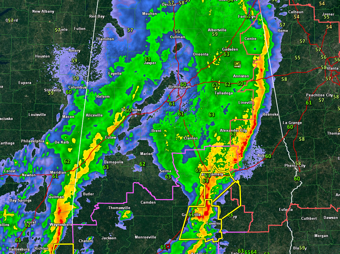
Our line of thunderstorms continues tonight from Cleburne County east of Anniston through Randolph County west of Wedowee to Tallapoosa County east of Dadeville to near Montgomery and Hope Hull.
The strongest storms are over Lowndes, Montgomery Bullock, and Pike Counties.
Severe thunderstorm warnings continue for parts of these counties.
There is an inflection point, or kink, in the line just south of Montgomery.
Rotation was crossing US-331 north of Luverne. It will pass north of Troy. We will be monitoring that for possible tornadic development.
There is not much instability except over extreme South Alabama and Northwest Florida. But any storms that develop can bring the 50-60 mph winds up at about 5,000 feet down to the surface easily.

The tornado watch continues for South and South Central Alabama. Severe eastern counties continue under the severe thunderstorm watch.
The NWS In Huntsville has canceled the watch for all of their counties.
Category: Alabama's Weather, ALL POSTS
About the Author (Author Profile)
Bill Murray is the President of The Weather Factory. He is the site's official weather historian and a weekend forecaster. He also anchors the site's severe weather coverage. Bill Murray is the proud holder of National Weather Association Digital Seal #0001 @wxhistorianSubscribe
If you enjoyed this article, subscribe to receive more just like it.


