Very Cool With Some Showers Out There At Midday On This Good Friday
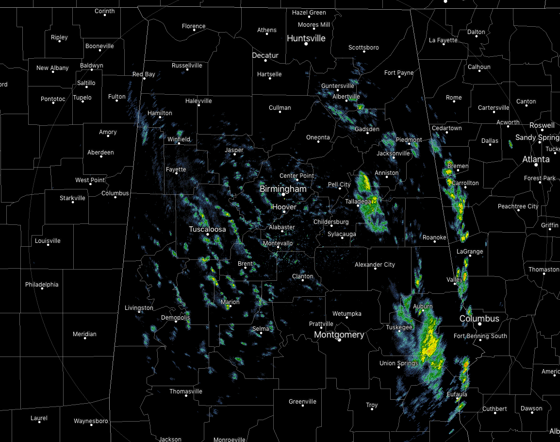
CONDITIONS AT 12:10 PM
We continue to have scattered showers wrapping around the center of low pressure that is just off to our north in eastern Tennessee. So far, no lightning is occurring with these showers and have not heard of any hail falling with these showers. Temperatures are currently in the upper 40s to the upper 50s throughout the area. Birmingham was at 54 degrees while Cullman is already down to 49 degrees. The warm spot is Selma at 59 degrees.
WEATHER FOR THE REST OF YOUR GOOD FRIDAY
As this very deep trough with a cold-core low continues to move off to the northeast and away from Central Alabama, we’ll continue to have a chance of showers throughout the area for the remainder of the daytime and through much of the night. Temperatures will continue to drop throughout the day with the high occurring just after midnight. Winds will be out of the west-northwest throughout the day at 15-20 MPH with gusts up to 30 MPH possible. Temperatures will be in the upper 40s to the mid-50s by late afternoon and in the mid-40s to the lower 50s by late evening. Overnight lows will bottom out in the lower to mid-40s.
SATURDAY
After a cold start to the morning, temperatures will rebound somewhat as any lingering shower activity will move out of the northeastern parts of Central Alabama and skies will be clearing. It will still be cool for this time of April, only reaching the lower to mid-60s for afternoon highs. A few locations in the southwestern parts may reach the upper 60s.
EASTER SUNDAY
For those heading to sunrise services, temperatures will start off in the lower to mid-40s across the area. With maximum sunshine, those temperatures will rise nicely, topping out in the mid to upper 70s. A very nice day to spend outdoors with the family hiding and hunting Easter Eggs. Skies remain clear through the evening and overnight hours, with lows dropping into the upper 40s to the lower 50s.
BEACH FORECAST CENTER
Get the latest weather and rip current forecasts for the beaches from Fort Morgan to Panama City on our Beach Forecast Center page. There, you can select the forecast of the region that you are interested in.
ALREADY OFF TO A HOT START IN 2019! ADVERTISE WITH THE BLOG!
We have enjoyed over 8.4 MILLION page views on AlabamaWx.com so far in 2019! Don’t miss out! We can customize a creative, flexible and affordable package that will suit your organization’s needs. Contact Bill Murray at (205) 687-0782.
E-FORECAST
Get the Alabama Wx Weather Blog’s Seven-Day Forecast delivered directly to your inbox by email twice daily. It is the most detailed weather forecast available in Central Alabama. Subscribe here… It’s free!
CONNECT WITH THE BLOG ON SOCIAL MEDIA
You can find the AlabamaWx Weather Blog on the major social media networks:
Facebook
Twitter
Instagram
WEATHERBRAINS
Don’t forget you can listen to our weekly 90 minute netcast anytime on the web at WeatherBrains.com or on iTunes, Stitcher, or Spotify. This is the show all about weather featuring many familiar voices, including the meteorologists at ABC 33/40.
Category: Alabama's Weather, ALL POSTS
About the Author (Author Profile)
Scott Martin is an operational meteorologist, professional graphic artist, musician, husband, and father. Not only is Scott a member of the National Weather Association, but he is also the Central Alabama Chapter of the NWA president. Scott is also the co-founder of Racecast Weather, which provides forecasts for many racing series across the USA. He also supplies forecasts for the BassMaster Elite Series events including the BassMaster Classic.Subscribe
If you enjoyed this article, subscribe to receive more just like it.


