Midday Nowcast: Mainly Sunny and Very Warm Tuesday
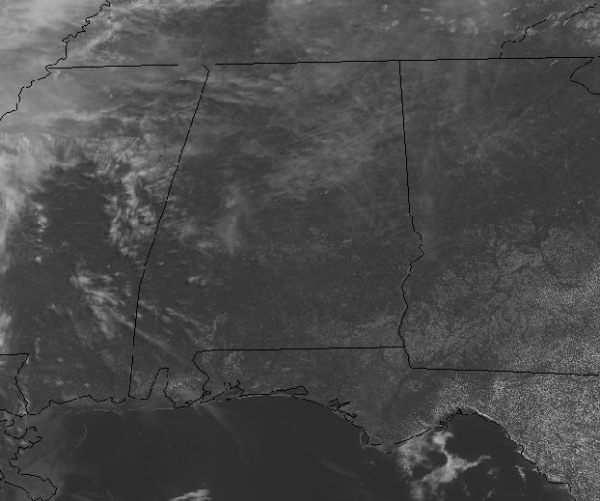
THE FINAL DAY OF APRIL: Plenty of sunshine again today and we are staying dry and very warm. Today will be the warmest day of the year so far as we are going to be seeing afternoon highs in the mid to upper 80s statewide, and I would not be surprised to see a few 90 degree readings on the map this afternoon.
Tonight will feature passing clouds, with the chance of some patchy fog in a couple of locations overnight. It will be a very mild night with lows generally in the mid 60s.
HELLO MAY: As we roll into the new month tomorrow, our moisture levels will begin to increase, and both Wednesday and Thursday will feature a mix of sun and clouds. With the higher moisture levels, we will introduce the chance of a few isolated afternoon showers on these two days; nothing heavy or widespread and most locations will be staying dry. It will remain very warm with highs in the mid 80s and we will have to mention it will be feeling a bit more humid as well.
HIGHER RAIN CHANCES: Showers will become a bit more numerous Friday and Saturday as a weak surface front approaches the state. We will also introduce the chance for a few thunderstorms at times as there will be sufficient instability in place across the state with the warm and humid air mass, but we are still not expecting any severe weather issues. For both Friday and Saturday, expect more clouds than sun with the occasional shower or storm, but no “washout” by any means. Both days will also feature highs be in the low to mid 80s. Rainfall totals through Saturday are not overly impressive with much of North/Central possibly receiving one-half to one inch.
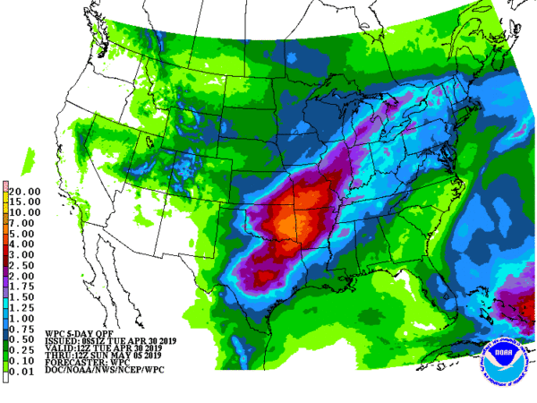
We trend drier across northern portions of the state Sunday as the frontal boundary looks to sink down into the southern portions of the state, confining the shower activity to that part of the state. We should see a sky with a mix of sun and clouds with highs in the lower to mid 80s.
BEACH FORECAST CENTER: Get the latest weather and rip current forecasts for the beaches from Fort Morgan to Panama City on our Beach Forecast Center page. There, you can select the forecast of the region that you are interested in visiting.
WORLD TEMPERATURE EXTREMES: Over the last 24 hours, the highest observation outside the U.S. was 117.3F at Matam, Senegal. The lowest observation was -98.0F at Concordia, Antarctica.
CONTIGUOUS TEMPERATURE EXTREMES: The highest observation was 101F at Rio Grande Village, TX. The lowest observation was 9F at Flapttop Mountain, MT.
WEATHER ON THIS DATE IN 1852: A tornado, following the same track as the famous “Tri-state Tornado” of 1925, struck the town of New Harmony IND. Just sixteen persons were killed by the twister, due to the sparse settlement. The “Tri-state Tornado” killed 695 persons.
Category: Alabama's Weather, ALL POSTS
About the Author (Author Profile)
Macon, Georgia Television Chief Meteorologist, Birmingham native, and long time Contributor on AlabamaWX. Stormchaser. I did not choose Weather, it chose Me. College Football Fanatic. @Ryan_StinnetSubscribe
If you enjoyed this article, subscribe to receive more just like it.


