

Strong To Marginally Severe Storms Possible On Thursday
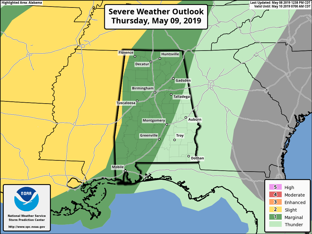
We continue to have a Marginal Threat for severe storms (level 1 of 5) for much of Central Alabama on Thursday with the exception of the extreme east and southeastern locations in the area. A Slight Risk (level 2 of 5) continues for nearly all of Mississippi and just barely into the extreme western parts of North/Central Alabama.
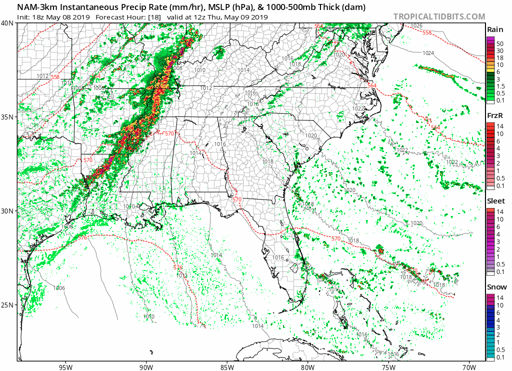
The 18z run of the NAM-3k has the possibility of showers and storms moving into the northwestern parts of the state as early as 10:00 am, but these will be in the process of weakening and dissipating as they move farther into North/Central Alabama. Wherever that boundary is left over is where we would need to watch for the redevelopment of showers and thunderstorms throughout the afternoon and early evening hours.
We will have plenty of instability in place over the area, and with a humid airmass in place and a shortwave moving through the area, showers and thunderstorms are expected to redevelop especially during the afternoon in the main heating of the day. I would not be surprised that we may have a couple form before the noon hour. Highs will get up into the lower to mid-80s for most across Central Alabama with dewpoints in the upper 60s to the lower 70s.
The best chances for these stronger to marginally severe storms will be over the northern parts of the area especially north of the I-20 corridor. The good news is the best deep layer shear will be well north and west of the area, the severe threat is minimal at best.
Activity is expected to decrease as we move through the evening and overnight hours on Thursday as this first shortwave will move to our north and east and we lose any force.
The main threat from these storms will be gusty winds and maybe isolated small hail. This will be more like a summertime-type thunderstorm event, so the threat will be from collapsing thunderstorms causing strong downdrafts. There is no tornado threat with this system at this point.
With a series of shortwaves expected to move through the area for the next several days, we can expect waves of showers and thunderstorms. No severe weather is expected on Friday and through the weekend, but we can’t rule out a strong storm or two.
Category: Alabama's Weather, ALL POSTS, Severe Weather
About the Author (Author Profile)
Scott Martin is an operational meteorologist, professional graphic artist, musician, husband, and father. Not only is Scott a member of the National Weather Association, but he is also the Central Alabama Chapter of the NWA president. Scott is also the co-founder of Racecast Weather, which provides forecasts for many racing series across the USA. He also supplies forecasts for the BassMaster Elite Series events including the BassMaster Classic.Subscribe
If you enjoyed this article, subscribe to receive more just like it.


