Rain & A Few Storms Moving In At The Stroke Of Midnight
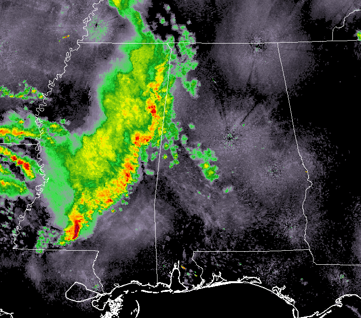
The line of rain and a few embedded storms continue to weaken as they begin to move into the western parts of North/Central Alabama right at the midnight hour. Lightning output with the line has really dropped off along with the intensity of the rainfall over the past hour since my last update.
The line will continue to weaken and lightning will continue to diminish through the next few hours of the overnight, and most (if not all) of this activity should die off before reaching the I-65 corridor.
Pickens, Lamar, Marion, Franklin, Colbert, and Lauderdale counties will be the first to have the line move through. While it may be noisy at times if any thunder occurs, severe storms are not expected with these storms.
NWS Jackson has allowed a tornado watch to expire at midnight that was in effect for much of southern 2/3rds of Mississippi. No other mesoscale discussions have been issued for this line as well, so other than some rain and maybe a few claps of thunder, it looks like we’re in good shape with no severe weather expected.
Category: Alabama's Weather, ALL POSTS
About the Author (Author Profile)
Scott Martin is an operational meteorologist, professional graphic artist, musician, husband, and father. Not only is Scott a member of the National Weather Association, but he is also the Central Alabama Chapter of the NWA president. Scott is also the co-founder of Racecast Weather, which provides forecasts for many racing series across the USA. He also supplies forecasts for the BassMaster Elite Series events including the BassMaster Classic.Subscribe
If you enjoyed this article, subscribe to receive more just like it.


