A Quick Check On Storms Approaching The State
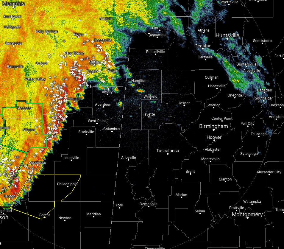
As of 8:04 am, we have another line of rain and thunderstorms moving through the eastern parts of Mississippi and is just starting to enter the extreme northwestern corner of North Alabama. While the northern parts of the line is below severe limits, there are a few severe thunderstorm warnings in effect on the southern parts with the possibility of 60 MPH winds.
While storms will be entering Lamar and Marion counties shortly with the main part of the line entering in about 30-60 minutes. For counties along the state line south of that, the line will be moving in around 2-3 hours.
There is some uncertainty about what this line will do as it moves east. The latest HRRR shows the line staying together and moving through North/Central Alabama before exiting the area around 7-8 pm. The latest high-resolution NAM has the line weakening considerably while moving into and across the area with a few scattered larger thunderstorm cells developing and dissipating throughout the afternoon. It is also painting a few stronger storms after that across the central parts of the area, mainly from 6-10 pm.
As of now, there is not that much instability over the area as it is confined to the southwestern parts where the CAPE is currently at 500 J/kg and a little higher. The earlier rain that moved in over the northern parts of the area helped stabilize the air, so maybe the NAM will win out in this battle.
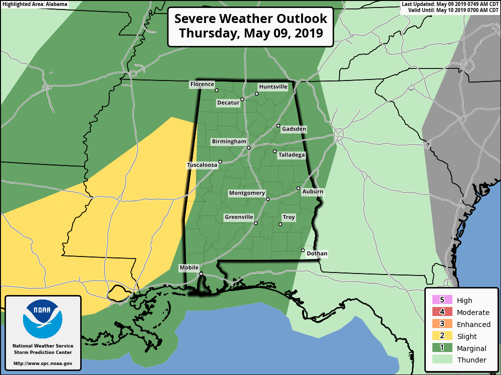
Nearly all of Alabama is under a Marginal Risk for severe storms throughout the day today with wind gusts up to 60 MPH being the main threat. There is no tornado threat throughout the day.
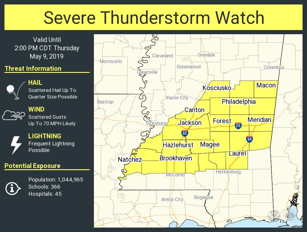
A Severe Thunderstorm Watch has been issued for a good portion on southern Mississippi until 2:00 pm today with wind gusts up to 70 MPH and quarter size hail being the main threats.
We’ll keep an eye on the radar throughout the day and if any warnings are issued, they will be auto-posted to the blog.
Category: Alabama's Weather, ALL POSTS, Severe Weather
About the Author (Author Profile)
Scott Martin is an operational meteorologist, professional graphic artist, musician, husband, and father. Not only is Scott a member of the National Weather Association, but he is also the Central Alabama Chapter of the NWA president. Scott is also the co-founder of Racecast Weather, which provides forecasts for many racing series across the USA. He also supplies forecasts for the BassMaster Elite Series events including the BassMaster Classic.Subscribe
If you enjoyed this article, subscribe to receive more just like it.


