SPC Upgrades To Slight Risk, Watch Issuance Possible
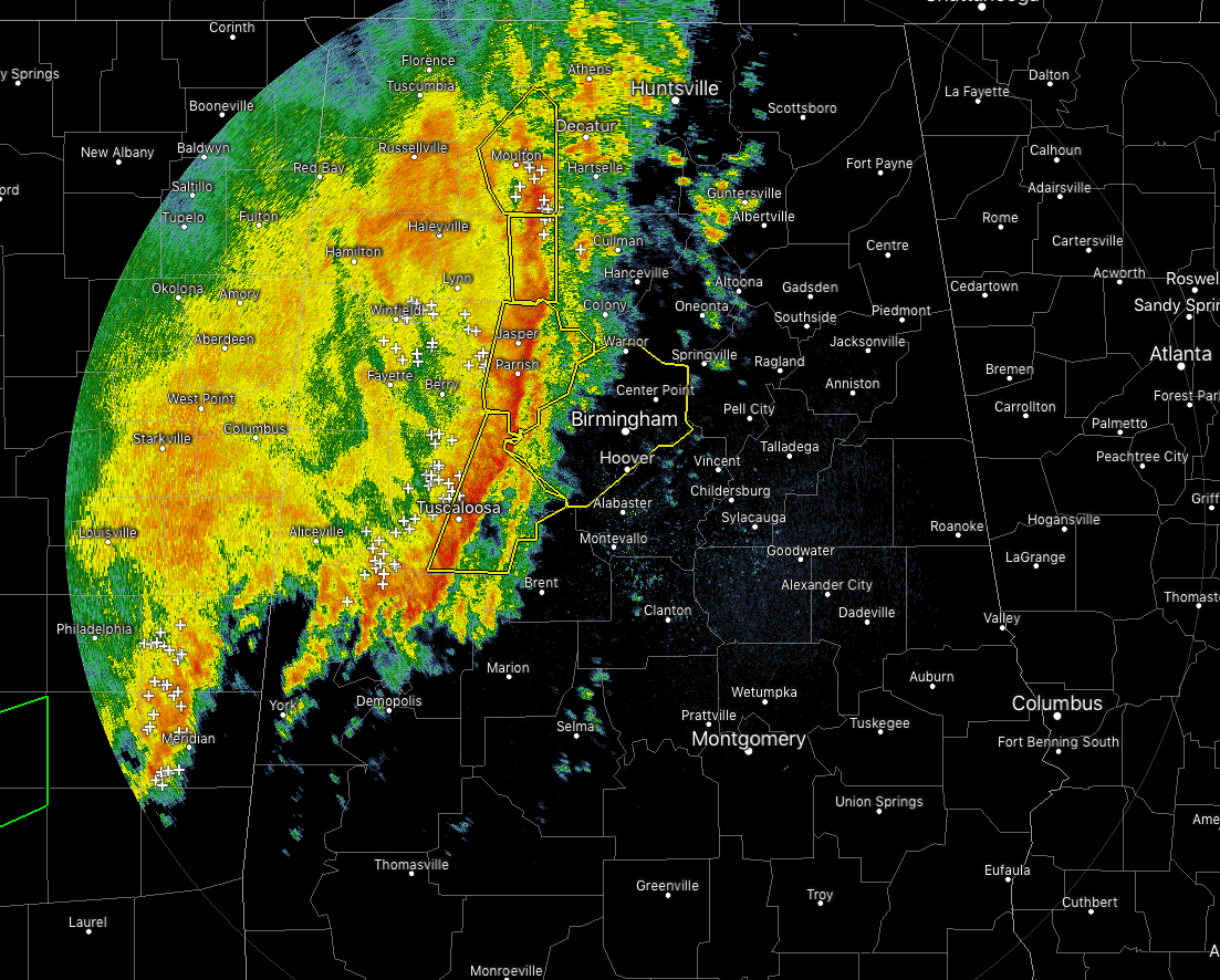
Strong to severe storms are now approaching the I-65 corridor in the central parts of North/Central Alabama as we are close to the start of the noon hour. Several severe thunderstorm warnings are in effect along the leading edge of the line for the possibility of damaging winds. If you are in the path of this line, seek shelter immediately and treat severe thunderstorm warnings the same as tornado warnings. Severe thunderstorms can cause serious damage along with injuries and even death.
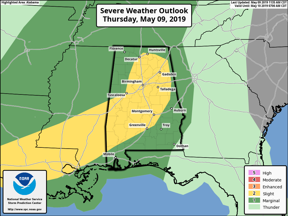
SPC has decided to upgrade the severe risk across much of North/Central Alabama to a Slight Risk for severe storms due to the increasing potential of damaging thunderstorm wind gusts and the possibility of rotation on the leading edge of the line of storms.
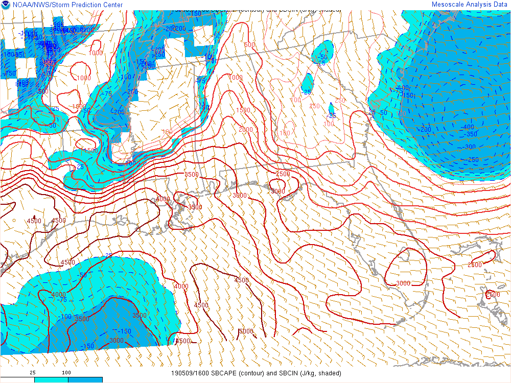
Instability continues to climb with CAPE values now at 1000-2500 J/kg across much of North/Central Alabama from northeast to southwest.

SPC is discussing the possibility of issuing a watch for the southwestern parts of the area. If one is issued, it should be out within the next hour or two.
Category: Alabama's Weather, ALL POSTS, Severe Weather
About the Author (Author Profile)
Scott Martin is an operational meteorologist, professional graphic artist, musician, husband, and father. Not only is Scott a member of the National Weather Association, but he is also the Central Alabama Chapter of the NWA president. Scott is also the co-founder of Racecast Weather, which provides forecasts for many racing series across the USA. He also supplies forecasts for the BassMaster Elite Series events including the BassMaster Classic.Subscribe
If you enjoyed this article, subscribe to receive more just like it.


