Brief Check At 1:15 PM, Strong To Severe Storms Continue
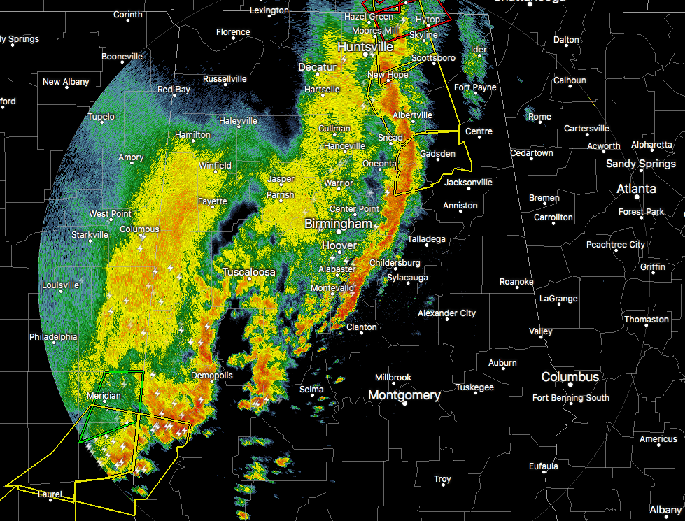
Storms continue to move across North/Central Alabama and have thrown a few surprises into the mix as we have had a few tornado and severe thunderstorm warnings. We have had a few reports of damage including trees and power lines being knocked down, along with possible roof damage to the Target Shopping Center in Huntsville.
The line currently stretches from Hytop to Gadsden to Pell City to Uniontown. Spin ups are occurring along the leading edge of the line and causing the issuance of these tornado warnings. If you are to the east and in the path of the line of storms, be prepared to take cover immediately if a warning is issued for your location, no matter if it is a tornado warning or severe thunderstorm warning.
Please excuse the delay in warning being posted to the site. I took a power hit and only working on laptop with 48% battery left and using the hotspot on my smartphone.
Category: Alabama's Weather, ALL POSTS, Severe Weather
About the Author (Author Profile)
Scott Martin is an operational meteorologist, professional graphic artist, musician, husband, and father. Not only is Scott a member of the National Weather Association, but he is also the Central Alabama Chapter of the NWA president. Scott is also the co-founder of Racecast Weather, which provides forecasts for many racing series across the USA. He also supplies forecasts for the BassMaster Elite Series events including the BassMaster Classic.Subscribe
If you enjoyed this article, subscribe to receive more just like it.


