SPC Removes Slight Risk But Expands Marginal Risk For Today
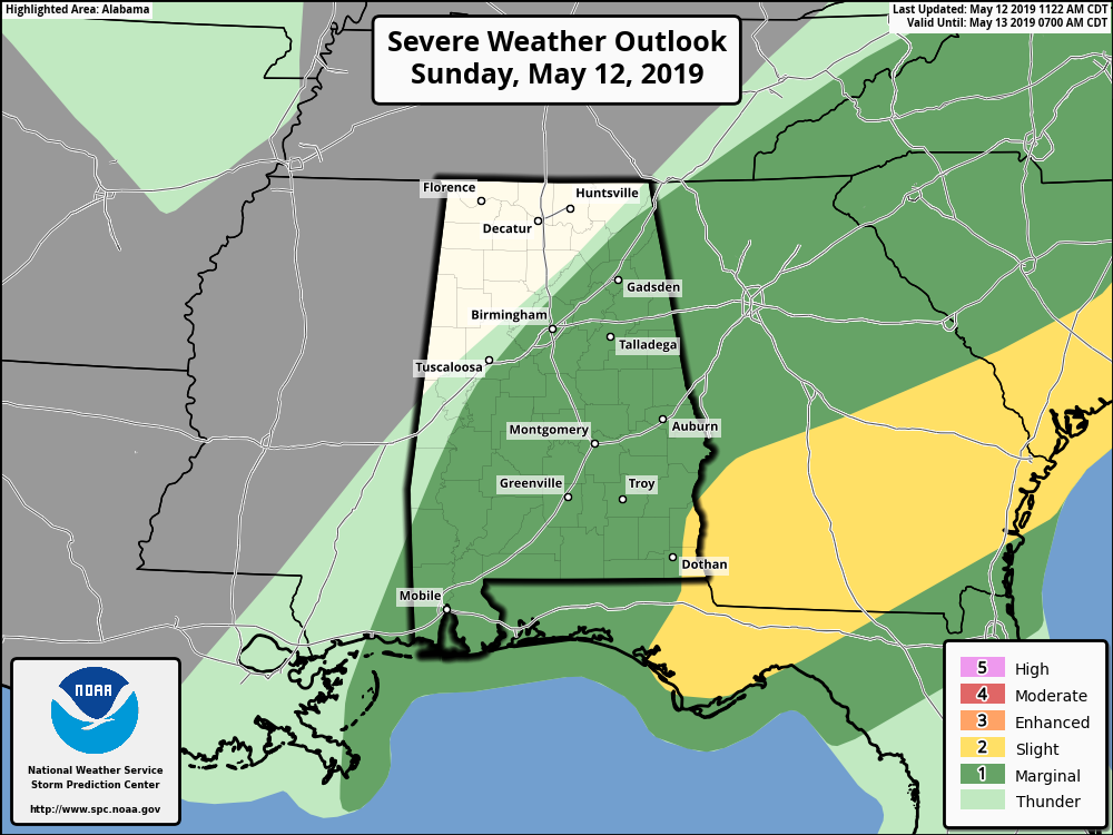
The Storm Prediction Center has removed the Slight Risk of severe storms for the southeastern parts of the area while expanding the Marginal Risk a little farther to the north. The Marginal Risk now includes all locations south of a line from Ider (Dekalb Co.) to Warrior (Jefferson Co.) to Demopolis (Marengo Co.).
There are signs for convective development along and ahead of the cold front across Central Alabama and up into the northeastern parts of North Alabama. While cloud cover over the area will limit destabilization somewhat, but enough instability should be able to form with the heating of the day that some scattered thunderstorms will develop with the potential of a few of those becoming strong to marginally severe. Threats will be isolated damaging wind gusts up to 60 MPH and quarter size hail.
The severe weather threat should come to an end around 7:00 pm tonight as the front will be out of the area at that point.
Category: Alabama's Weather, ALL POSTS, Severe Weather
About the Author (Author Profile)
Scott Martin is an operational meteorologist, professional graphic artist, musician, husband, and father. Not only is Scott a member of the National Weather Association, but he is also the Central Alabama Chapter of the NWA president. Scott is also the co-founder of Racecast Weather, which provides forecasts for many racing series across the USA. He also supplies forecasts for the BassMaster Elite Series events including the BassMaster Classic.Subscribe
If you enjoyed this article, subscribe to receive more just like it.


