A Quick Radar Check Just After 3:00 PM
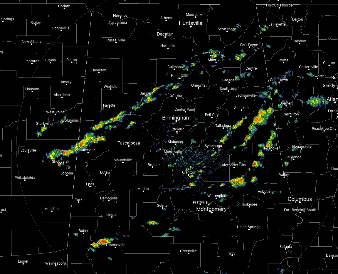
We continue to have some scattered shower activity across Central Alabama as we have reached the 3 o’clock hour on this Sunday afternoon. No lightning is occurring at this moment, and while some of these are producing moderate to heavy downpours, they are small in stature and will not last long. All of this activity continues to move to the east.
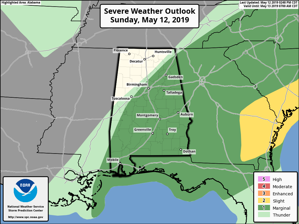
The Storm Prediction Center continues a Marginal Risk for all locations south of a line from Ider (Dekalb Co.) to Warrior (Jefferson Co.) to Demopolis (Marengo Co.). Threats are from isolated damaging wind gusts up to 60 MPH and quarter size hail.
Instability values are in the 500-1,500 J/kg across the area along with some shear in the 50-60 knots range, so there will be a very small chance of a cell or two start rotating. At this point, Significant Tornado Parameter values are up to 0.5 over the extreme southern parts of the area, and up to 1.0 in South Alabama.
Now we’ll just have to wait and see if any of these storms are able to start building and become strong. We’ll keep you updated throughout the rest of the afternoon and into the evening.
Category: Alabama's Weather, ALL POSTS, Severe Weather
About the Author (Author Profile)
Scott Martin is an operational meteorologist, professional graphic artist, musician, husband, and father. Not only is Scott a member of the National Weather Association, but he is also the Central Alabama Chapter of the NWA president. Scott is also the co-founder of Racecast Weather, which provides forecasts for many racing series across the USA. He also supplies forecasts for the BassMaster Elite Series events including the BassMaster Classic.Subscribe
If you enjoyed this article, subscribe to receive more just like it.


