A Brief Check On The Weather Just After 8:00 PM
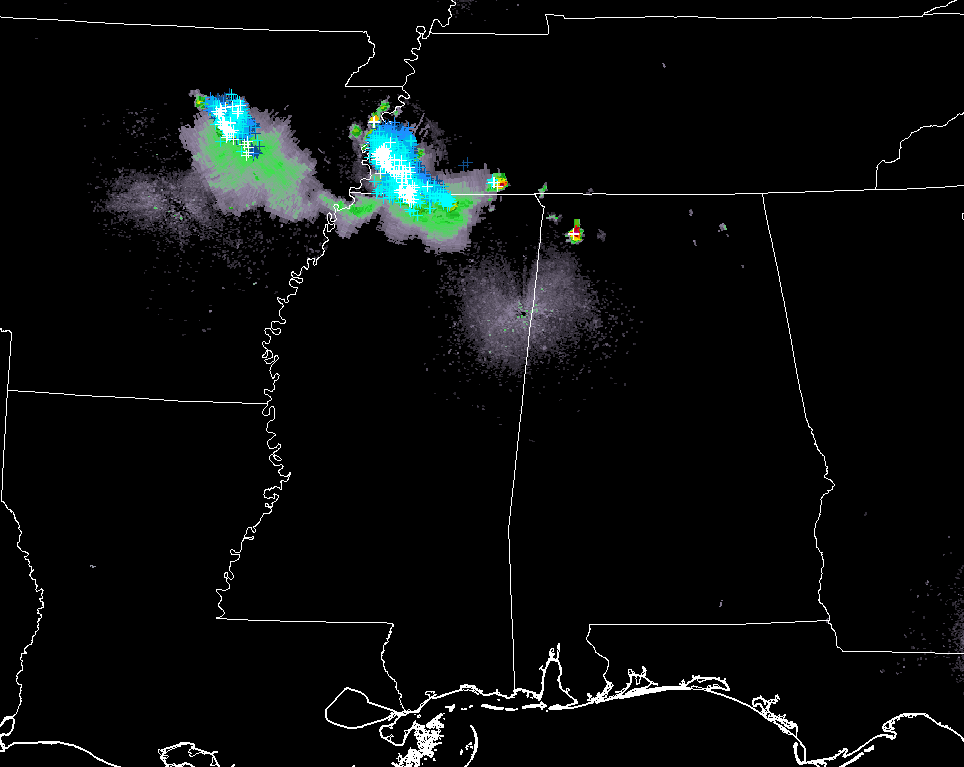
A quick radar check shows a strong thunderstorm over the northwestern parts of Alabama as we have made it into the 8 o’clock hour tonight. A Significant Weather Advisory has just been issued for parts of Colbert, Franklin, and Lawrence counties until 8:45 pm for a cell that is near Littleville and moving to the southeast at 15 MPH. Penny size hail and gusty winds up to 40 MPH can be expected with this cell.
Other than that, the rest of North/Central Alabama is and has been rather quiet with just a few isolated showers moving through and dissipating earlier today.
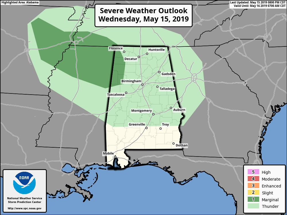
A Marginal Risk continues for the extreme northwestern parts of North/Central Alabama throughout the rest of tonight with isolated damaging winds and brief hail up to quarter size are the threats.
Thunderstorms are moving through the northern parts of Mississippi, southwestern parts of Tennessee, and the eastern parts of Arkansas. There is a chance that these could make it into the northwestern parts of North/Central Alabama before the night time is over with, and that is why there is a marginal risk. Models, however, have it falling apart and dissipating in just a few hours so we’ll have to wait and see what happens.
If any warnings are issued, we’ll have them up on the blog.
Category: Alabama's Weather, ALL POSTS, Severe Weather
About the Author (Author Profile)
Scott Martin is an operational meteorologist, professional graphic artist, musician, husband, and father. Not only is Scott a member of the National Weather Association, but he is also the Central Alabama Chapter of the NWA president. Scott is also the co-founder of Racecast Weather, which provides forecasts for many racing series across the USA. He also supplies forecasts for the BassMaster Elite Series events including the BassMaster Classic.Subscribe
If you enjoyed this article, subscribe to receive more just like it.


