

Clouds Increasing, Winds Picking Up, But Showers and Storms Weakening
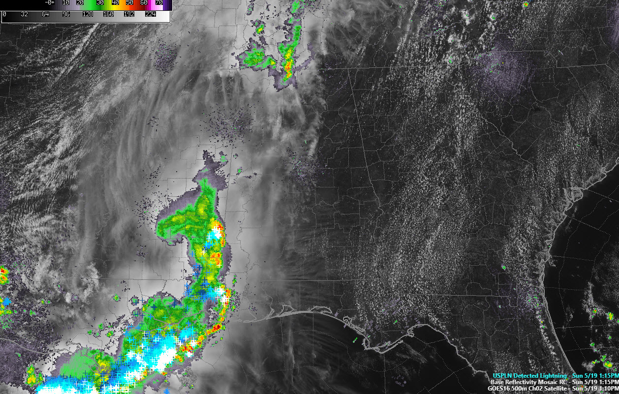
We continue to monitor a mesoscale convective vortex moving into West Central and Southwest Alabama. It is, unfortunately, running out of steam.
The vertex of the MCV is located near Laurel, MS and the comma head and its attendant rain and storms are moving into Choctaw County.
The storms are not severe but do have heavy rain, lightning, and gusty winds.
The system has weakened a bit, but it may make it well into West Alabama before it fizzles, running into more hostile conditions as it goes.
For most everyone else, it will be a hot and breezy afternoon with highs in the middle and upper 80s.
More showers and storms may drift down into Northwest Alabama this evening. But they should weaken before they reach I-59.
Get ready for a heat wave, a tropical heat wave. It starts Tuesday as highs soar into the 90s for each day remaining in the week.
Category: Alabama's Weather, ALL POSTS
About the Author (Author Profile)
Bill Murray is the President of The Weather Factory. He is the site's official weather historian and a weekend forecaster. He also anchors the site's severe weather coverage. Bill Murray is the proud holder of National Weather Association Digital Seal #0001 @wxhistorianSubscribe
If you enjoyed this article, subscribe to receive more just like it.


