Dry & Getting Hot At Midday, Tropical Mischief Could Bring Enhanced Rainfall Later This Week
CONDITIONS AT 11:20 AM
We have a great deal of sunshine out there as we approach the midday hour, but we do have a few clouds and some haze from smoke that is being pulled into the area from wildfires up in Canada. The good news is the smoke is well up in the atmosphere, so we shouldn’t see any problems with it. Temperatures are in the lower 80s to the lower 90s across the area. Birmingham was at 86 degrees. A few locations are tied at 91 degrees as the hot spots.
WE STAY DRY & HOT THROUGH TONIGHT & ON TUESDAY
For the rest of today, we’ll continue to have mostly clear skies with very warm to hot temperatures across Central Alabama. Afternoon highs will be in the upper 80s to the mid-90s across the area. Tonight will be mostly clear with lows in the 60s. For Tuesday, skies remain mostly sunny with afternoon highs reaching the upper 80s to the mid-90s once again.
TROPICAL MISCHIEF COULD AFFECT CENTRAL ALABAMA
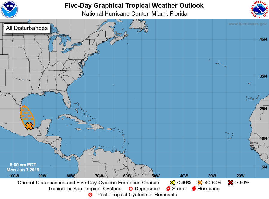
While we continue to have a tropical disturbance over the Bay of Campeche in the southwestern Gulf of Mexico that will eventually move inland over Mexico within the next 24-36 hours, interest is starting to grow up here in Central Alabama.
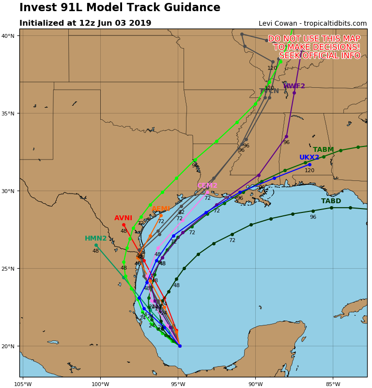
While we are not in a threat of a landfalling system directly, the remnants of this disturbance may be pulled up into the southeastern United States and enhancing rainfall that we are already forecast to get for the end of the work week and into the weekend.

Latest projections from the WPC are now showing rainfall totals throughout the week and weekend ranging from 2.00-4.00 inches across Central Alabama, with the highest totals in the northwestern parts of the area. If this holds true, it will bring relief to those locations that are experiencing abnormally dry conditions. By the way, Barry will be the name if the disturbance strengthens into a tropical storm. Chances of a depression/storm forming are around 60%.
ON THIS DAY IN WEATHER HISTORY
1921 – A cloudburst near Pikes Peak CO killed 120 people. Pueblo CO was flooded by a twenty-five-foot crest of the Arkansas River, killing 70 persons. Fourteen inches of rain was reported at Boggs Flat, where a hard surface road through the nearly level country was washed out to a depth of seven feet.
BEACH FORECAST CENTER
Get the latest weather and rip current forecasts for the beaches from Fort Morgan to Panama City on our Beach Forecast Center page. There, you can select the forecast of the region that you are interested in.
ALREADY OFF TO A HOT START IN 2019! ADVERTISE WITH THE BLOG!
We have enjoyed over 10 MILLION page views on AlabamaWx.com so far in 2019! Don’t miss out! We can customize a creative, flexible and affordable package that will suit your organization’s needs. Contact Bill Murray at (205) 687-0782.
E-FORECAST
Get the Alabama Wx Weather Blog’s Seven-Day Forecast delivered directly to your inbox by email twice daily. It is the most detailed weather forecast available in Central Alabama. Subscribe here… It’s free!
CONNECT WITH THE BLOG ON SOCIAL MEDIA
You can find the AlabamaWx Weather Blog on the major social media networks:
Facebook
Twitter
Instagram
WEATHERBRAINS
Don’t forget you can listen to our weekly 90 minute netcast anytime on the web at WeatherBrains.com or on iTunes, Stitcher, or Spotify. This is the show all about weather featuring many familiar voices, including the meteorologists at ABC 33/40.
Category: Alabama's Weather, ALL POSTS
About the Author (Author Profile)
Scott Martin is an operational meteorologist, professional graphic artist, musician, husband, and father. Not only is Scott a member of the National Weather Association, but he is also the Central Alabama Chapter of the NWA president. Scott is also the co-founder of Racecast Weather, which provides forecasts for many racing series across the USA. He also supplies forecasts for the BassMaster Elite Series events including the BassMaster Classic.Subscribe
If you enjoyed this article, subscribe to receive more just like it.


