Numerous Showers And A Few Storms At Midday
CONDITIONS AT 11:20 AM
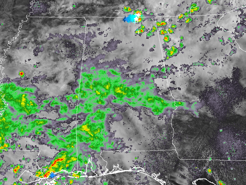
Skies are cloud-filled across Central Alabama with numerous showers falling over the southern and southwestern parts of the area. We also have a few thunderstorms up in the extreme northeastern parts of the state just north of the area, but none are reported to be strong at this point. Temperatures are in the upper 70s to the mid-80s throughout the area. The cool spot was Prattville at 78 degrees while the warm spots were Auburn and Troy at 84 degrees. Birmingham was at 82 degrees.
WEATHER FOR THE REST OF YOUR WEDNESDAY
Scattered to numerous showers and a few thunderstorms will continue to be possible across Central Alabama for the rest of the daylight hours with the higher chances remaining in the south and southwestern parts of the area. Afternoon highs will stay in the 80s across the area due to the cloud cover and rainfall. Rain chances range from 40% to 60% from northeast to southwest. For tonight and through the overnight hours, we’ll continue to have a chance of showers and maybe a few claps of thunder. Lows will be in the upper 60s to the lower 70s.
MORE RAIN & STORMS ON YOUR THURSDAY
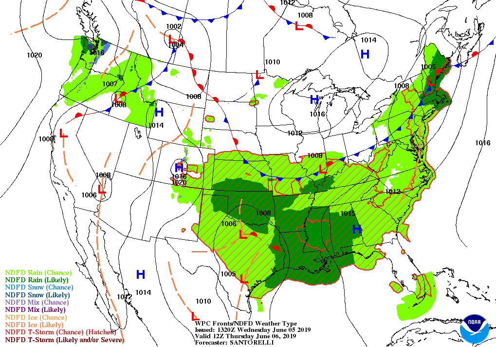
As the upper trough combined with moisture from the remnants of the tropical disturbance moves closer to the area, rain and a few thunderstorms will be likely throughout the entire day. There will be breaks in the rain, but it will be an overall wet day with 1/4-inch to 1-inch rainfall totals possible (from southeast to northwest). Afternoon highs will stay in the upper 70s to the mid-80s across the area from northwest to southeast. Lows will be in the upper 60s to the lower 70s.
CHECK ON THE TROPICS
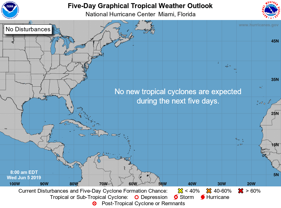
The Atlantic Basin is all quiet at this time and no tropical systems are expected to form within the next 5 days.
ON THIS DAY IN WEATHER HISTORY
1916 – A tornado struck the town of Warren AR killing 83 persons. There were 125 deaths that day in a tornado outbreak across Missouri and Arkansas.
Category: Alabama's Weather, ALL POSTS
About the Author (Author Profile)
Scott Martin is an operational meteorologist, professional graphic artist, musician, husband, and father. Not only is Scott a member of the National Weather Association, but he is also the Central Alabama Chapter of the NWA president. Scott is also the co-founder of Racecast Weather, which provides forecasts for many racing series across the USA. He also supplies forecasts for the BassMaster Elite Series events including the BassMaster Classic.Subscribe
If you enjoyed this article, subscribe to receive more just like it.


