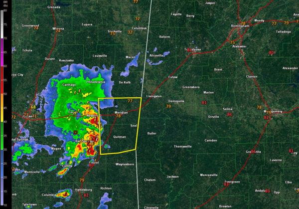
Strong Storms Over Eastern Mississippi Will Move Into West Alabama Before 10 a.m.
A complex of storms moving across eastern Mississippi will enter West Alabama’s Choctaw and Sumter Counties before 10 a.m.
Severe thunderstorm warning is in effect for Jasper. Newton, Scott, and Smith counties in eastern Mississippi. A new warning was just issued for Clarke, Jasper, Lauderdale, and Newton, including the Meridian area.
There have been scattered reports of trees down with the storms, including some in Jackson.
There is moderate instability over Alabama ahead of the storms, so they should be able to continue to intensify. The main threat will be damaging winds with gusts to 60 mph or stronger. I suppose there could be some small hail as well.
The tornado threat is very, very low.
The SPC just noted that a watch is unlikely. A marginal risk for severe weather does cover much of Alabama today.
The storms are receiving some upper-level support from a narrow jet feature in the upper atmosphere on the south side of an upper low over Arkansas. Bulk wind shear values are not impressive, but the storms are probably being organized by some disturbance that will help hold them together.
Be alert for heavy rain as well. Precipitable water values are running 1.6-1.7 inches, which can result in some heavy rain. There will be plenty of lightning as well.
Look for the storms to stretch from Tuscaloosa to Marion to Camden by 11:30 or so and from Birmingham to Montgomery by 12:30 or so. Those times are subject to significant change, so stay tuned, as the system may slow a bit.
Category: Alabama's Weather, ALL POSTS


