Strong Storms Moving Into The Southwestern Parts Of The Area
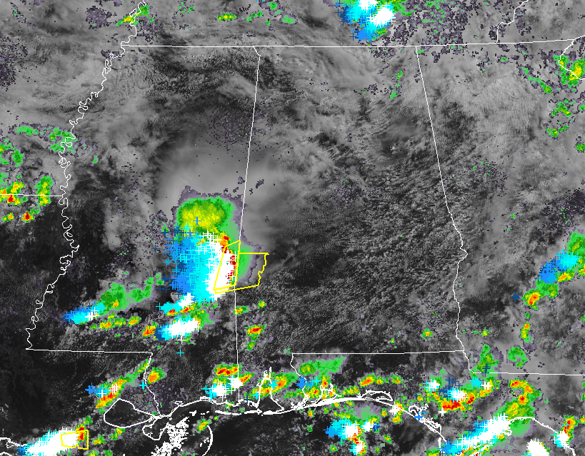
A batch of strong to severe thunderstorms are now starting to enter the southwestern parts of Alabama and a Severe Thunderstorm Warning is currently in effect for parts of Choctaw County until 10:15 am this morning. Damaging winds up to 60 MPH are possible with these storms as they move to the east at 45 MPH. Lisman, Butler, Needham, Toxey, Gilbertown, and Pennington are all in the path of these storms.
The northern parts of these storms will move into Sumter and Pickens counties within the next 15-30 minutes. Some gusty winds and dangerous cloud-to-ground lightning can be expected with these storms as they move east at 45 MPH.
Other than a few isolated showers in the eastern parts of North Alabama, the rest of North/Central Alabama is dry at the moment with partly to mostly cloudy skies.
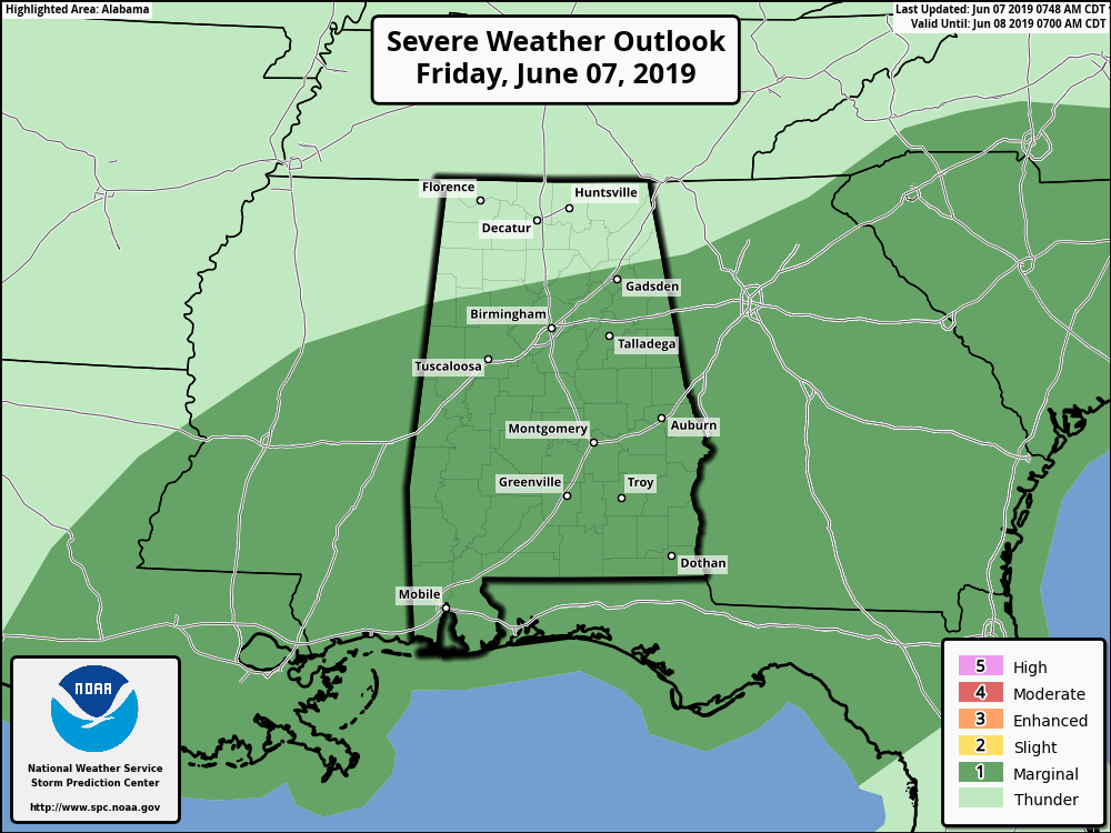
SPC continues a Marginal Risk of severe storms for nearly all of Central Alabama with the exception of the extreme northern parts of the area through the rest of the day. Isolated damaging wind gusts up to 60 MPH will be the main threat, but we cannot rule out the possibility of a brief isolated tornado or two.
We’ll keep you posted throughout the day.
Category: Alabama's Weather, ALL POSTS, Severe Weather
About the Author (Author Profile)
Scott Martin is an operational meteorologist, professional graphic artist, musician, husband, and father. Not only is Scott a member of the National Weather Association, but he is also the Central Alabama Chapter of the NWA president. Scott is also the co-founder of Racecast Weather, which provides forecasts for many racing series across the USA. He also supplies forecasts for the BassMaster Elite Series events including the BassMaster Classic.Subscribe
If you enjoyed this article, subscribe to receive more just like it.


