Strong To Severe Storms Continue; Severe T-Storm Watch Issued
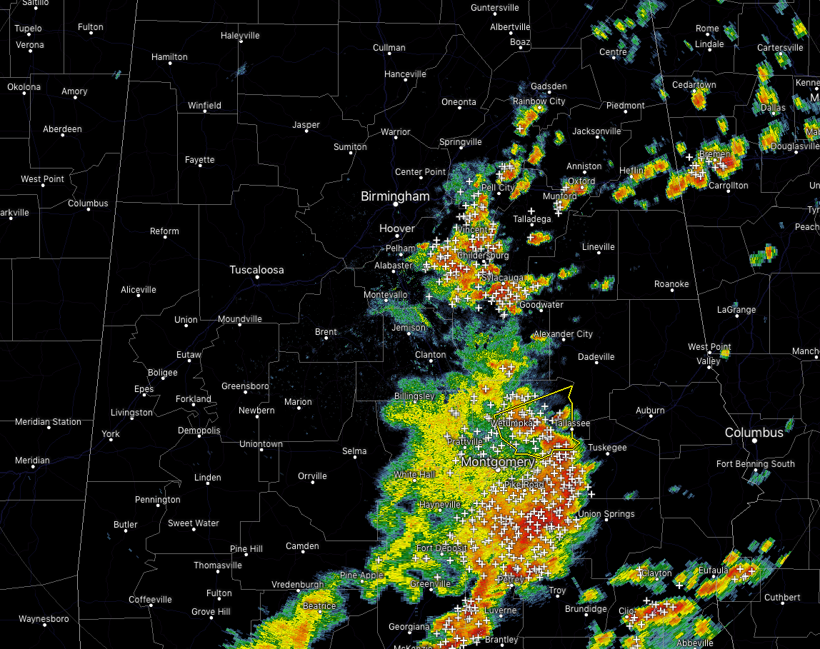
Strong to severe thunderstorms continue to move across a good portion of the southern half of Central Alabama. Gusty winds, dangerous cloud-to-ground lightning, and heavy rainfall are occurring with this complex as it moves off to the east at 45 MPH.
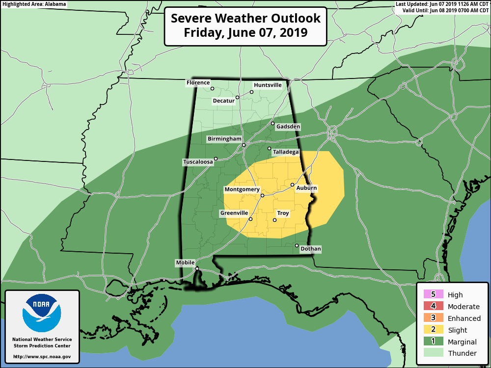
SPC continues a Marginal Risk for much of Central Alabama, while they have upgraded the south and southeastern parts to a Slight Risk for severe storms through the rest of the day. Damaging winds up to 60 MPH will be the main threat, but we can’t rule out a brief isolated tornado or two.
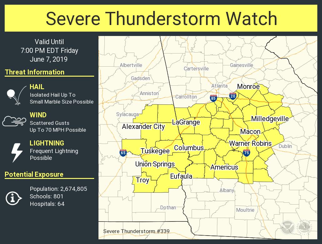
A Severe Thunderstorm Watch has been issued for the east and southeastern parts of Central Alabama including Barbour, Bullock, Chambers, Clay, Elmore, Lee, Macon, Pike, Randolph, Russell, Tallapoosa counties until 6:00 PM tonight.
A cluster of storms in Alabama will likely persist through the afternoon while spreading eastward and moving into Georgia. The environment downstream from the storms appears supportive of strong downdrafts and the potential for occasional damaging gusts.
Category: Alabama's Weather, ALL POSTS, Severe Weather
About the Author (Author Profile)
Scott Martin is an operational meteorologist, professional graphic artist, musician, husband, and father. Not only is Scott a member of the National Weather Association, but he is also the Central Alabama Chapter of the NWA president. Scott is also the co-founder of Racecast Weather, which provides forecasts for many racing series across the USA. He also supplies forecasts for the BassMaster Elite Series events including the BassMaster Classic.Subscribe
If you enjoyed this article, subscribe to receive more just like it.


