Back To A Marginal Risk For The Rest Of The Day; Severe T-Storm Watch Canceled
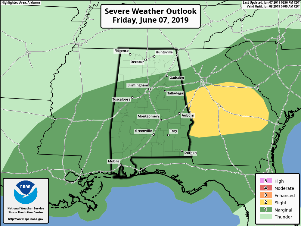
SPC has removed the Slight Risk for severe storms from Central Alabama as the mass of storms that have caused some damage in the southern parts of the area have now pushed over into Georgia. A Marginal Risk remains for much of Central Alabama through the remainder of the day and tonight as we will have more storms move in from the west later this afternoon and evening.
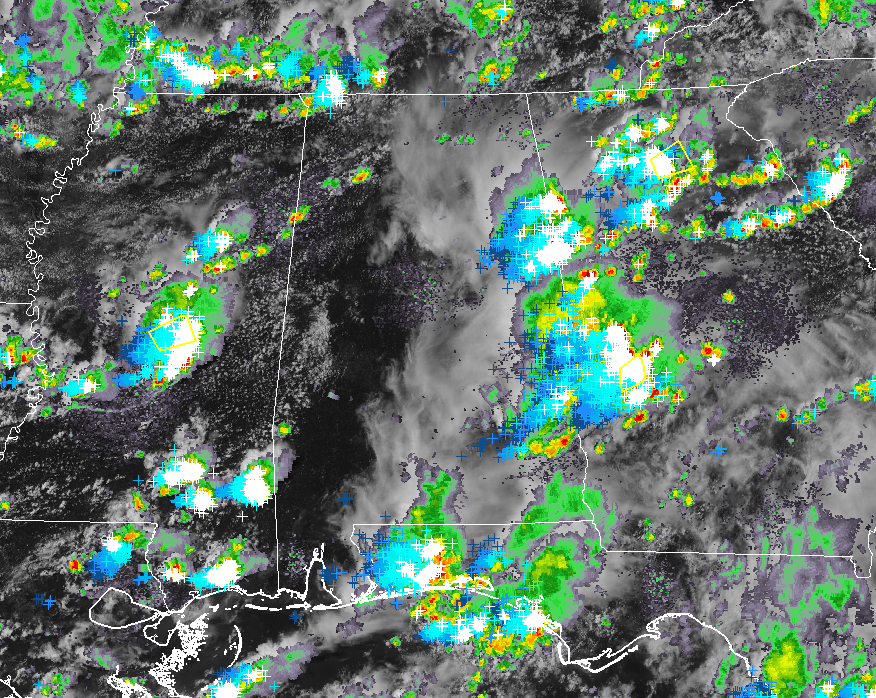
We’ll have to watch storms as they move into the western parts of the area as there is currently a good bit of sunshine warming the surface at this point. Strong storms are over east-central parts of Mississippi that will be moving into the western parts of Central Alabama over the next couple of hours. CAPE Values are over 1500-2500 J/kg over the western half of the area which will allow thunderstorms to either continue at their strength or grow stronger. There is just enough shear over the south and southwestern parts of the area that there is a small threat of a brief isolated tornado or two, but the main threat will be from damaging winds up to 60 MPH.
Multiple trees have been reported downed by damaging winds, especially in parts of Lee, Tallapoosa, and Elmore counties. Dannelly Field in Montgomery reported a peak wind gust of 59 MPH when a severe thunderstorm moved through earlier this afternoon.
We’ll continue to keep you updated throughout the rest of the day.
Category: Alabama's Weather, ALL POSTS, Severe Weather
About the Author (Author Profile)
Scott Martin is an operational meteorologist, professional graphic artist, musician, husband, and father. Not only is Scott a member of the National Weather Association, but he is also the Central Alabama Chapter of the NWA president. Scott is also the co-founder of Racecast Weather, which provides forecasts for many racing series across the USA. He also supplies forecasts for the BassMaster Elite Series events including the BassMaster Classic.Subscribe
If you enjoyed this article, subscribe to receive more just like it.


