Stronger Storms Continue Across The Western Parts Of Central Alabama
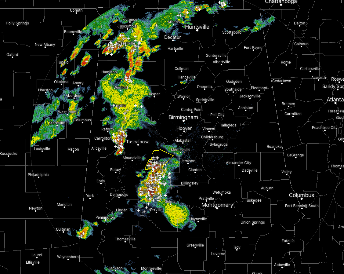
At 6:55 pm, we have a few scattered strong storms across North/Central Alabama… one of which has prompted a Severe Thunderstorm Warning for parts of Bibb County until 7:30 pm this evening. Damaging winds up to 60 MPH and hail up to 1.00 inch in diameter remains possible with this cell. It is moving to the northeast at 30 MPH.
Another strong cell is affecting the western parts of Tuscaloosa County and a Significant Weather Advisory is in effect until 7:30 PM. This cluster is moving to the east at 35 MPH with the main threat being gusty winds up to 40 MPH.
All of these storms are producing heavy downpours, dangerous cloud-to-ground lightning, and gusty winds. If one is approaching your location, move indoors immediately.
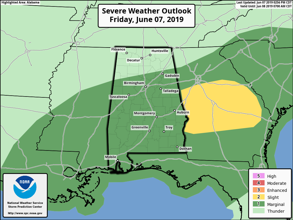
A Marginal Risk remains for much of Central Alabama through the remainder of the day and tonight as damaging winds up to 60 MPH will be the main threat, but with a low amount of shear, a brief spin-up tornado or two may be possible.
Category: Alabama's Weather, ALL POSTS, Severe Weather
About the Author (Author Profile)
Scott Martin is an operational meteorologist, professional graphic artist, musician, husband, and father. Not only is Scott a member of the National Weather Association, but he is also the Central Alabama Chapter of the NWA president. Scott is also the co-founder of Racecast Weather, which provides forecasts for many racing series across the USA. He also supplies forecasts for the BassMaster Elite Series events including the BassMaster Classic.Subscribe
If you enjoyed this article, subscribe to receive more just like it.


