Heads Up In Fort Payne & Pine Ridge
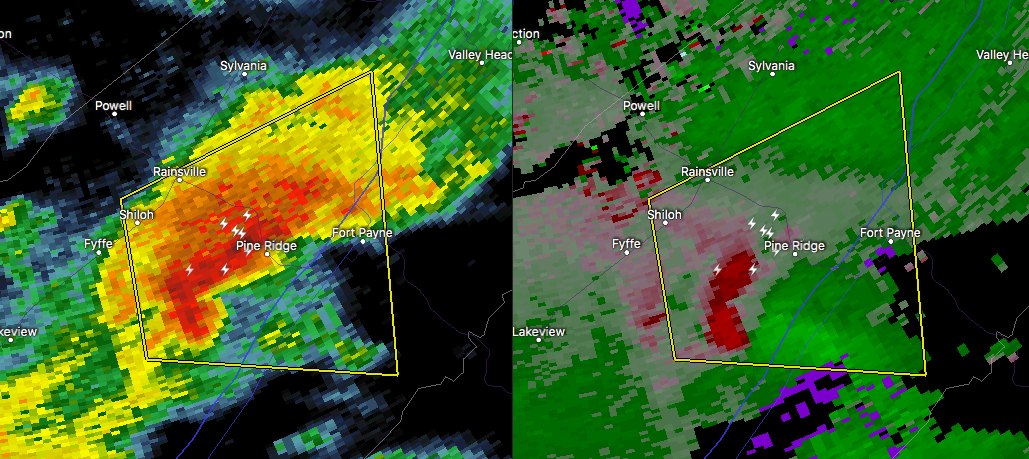
A severe thunderstorm is moving northeast through the central parts of Dekalb County which is showing signs of rotation. NWS Chat is reporting that there is a rain-free base and a possible wall cloud (WHNT camera). Right now the main threat continues to be from damaging winds up to 60 MPH and some hail, but there has been just enough bulk shear to get some of these storms to rotate. Cell is moving east at 10 MPH.
If you live in the path of this storm, get to your safe place until it passes your location. Don’t take an unnecessary risk… be on the safe side.
Category: Alabama's Weather, ALL POSTS, Severe Weather
About the Author (Author Profile)
Scott Martin is an operational meteorologist, professional graphic artist, musician, husband, and father. Not only is Scott a member of the National Weather Association, but he is also the Central Alabama Chapter of the NWA president. Scott is also the co-founder of Racecast Weather, which provides forecasts for many racing series across the USA. He also supplies forecasts for the BassMaster Elite Series events including the BassMaster Classic.Subscribe
If you enjoyed this article, subscribe to receive more just like it.


