Getting Hot At Midday, Few Showers Popping Up
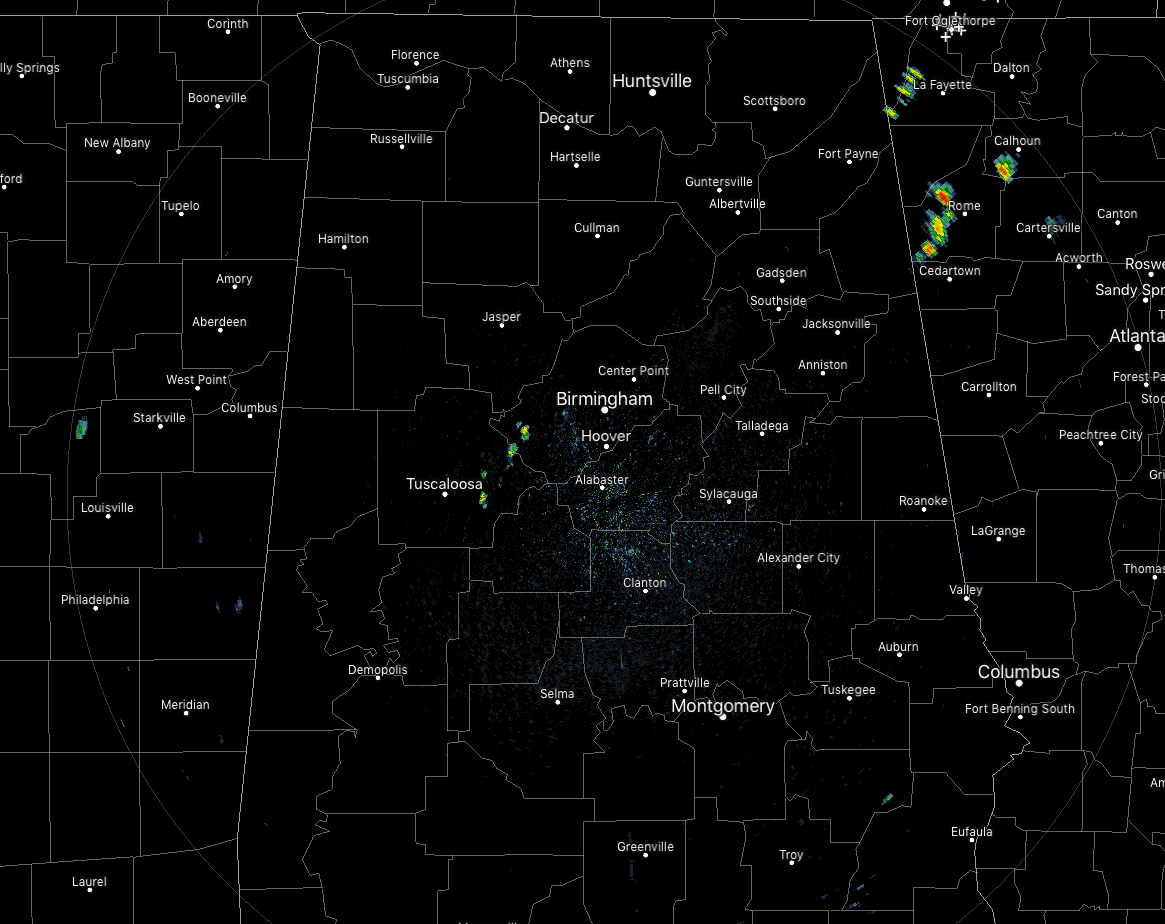
While we have only a few isolated showers showing up on radar over the eastern parts of Tuscaloosa County and western parts of Jefferson County, we expect to see more showers and thunderstorms develop during the afternoon and into the early evening hours. At 12:15 pm, temperatures were in the mid to upper 80s across much of the area, but a few 90s were being reported in the southern parts of the area. Birmingham was at 84 degrees, tied with several locations as the cool spot.
Showers and thunderstorm chances will increase during the main heating of the day, especially in the afternoon to the early evening hours. Higher chances will be north of the I-59 corridor, with another more likely spot south of the I-85 corridor. Afternoon highs will be in the upper 80s to the lower 90s across the area. We’ll continue to have showers and thunderstorms linger into the late night and overnight hours, with the higher chances remaining along and north of the I-59 corridor. Lows will be in the upper 60s to the lower 70s.
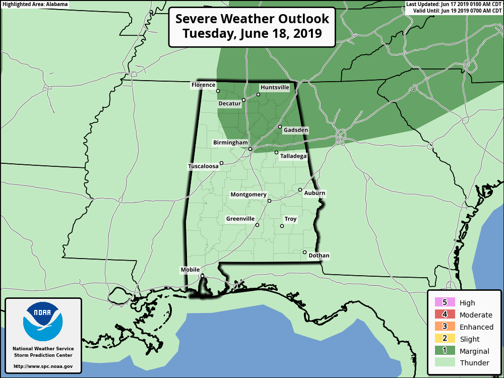
Tuesday will feature showers and thunderstorms likely at any point through the day, with the potential of a few of these storms becoming strong to marginally severe, especially over the northern half of the area. SPC has introduced a Marginal Risk for severe storms for much of the northern half of Alabama with isolated damaging wind gusts up to 60 MPH being the main threat. Afternoon highs will be in the mid to upper 80s for most with a few locations hitting the lower 90s in the southeastern parts of the area.
A QUICK LOOK AT THE TROPICS
The Atlantic Basin remains quiet today and no new tropical cyclones are expected to develop during the next five days.
ON THIS DAY IN WEATHER HISTORY
1882 – A tornado traveled more than 200 miles across the state of Iowa killing 130 persons. The tornado touched down about ninety miles west of Grinnell and struck the town and college around sunset, killing sixty persons, and causing more than half a million dollars damage. Traveling at nearly 60 mph, the tornado hit Mount Pleasant about 11 PM causing another half a million dollars damage.
BEACH FORECAST CENTER
Get the latest weather and rip current forecasts for the beaches from Fort Morgan to Panama City on our Beach Forecast Center page. There, you can select the forecast of the region that you are interested in.
ALREADY OFF TO A HOT START IN 2019! ADVERTISE WITH THE BLOG!
We have enjoyed over 10 MILLION page views on AlabamaWx.com so far in 2019! Don’t miss out! We can customize a creative, flexible and affordable package that will suit your organization’s needs. Contact Bill Murray at (205) 687-0782.
E-FORECAST
Get the Alabama Wx Weather Blog’s Seven-Day Forecast delivered directly to your inbox by email twice daily. It is the most detailed weather forecast available in Central Alabama. Subscribe here… It’s free!
CONNECT WITH THE BLOG ON SOCIAL MEDIA
You can find the AlabamaWx Weather Blog on the major social media networks:
Facebook
Twitter
Instagram
WEATHERBRAINS
Don’t forget you can listen to our weekly 90 minute netcast anytime on the web at WeatherBrains.com or on iTunes, Stitcher, or Spotify. This is the show all about weather featuring many familiar voices, including the meteorologists at ABC 33/40.
Category: Alabama's Weather, ALL POSTS
About the Author (Author Profile)
Scott Martin is an operational meteorologist, professional graphic artist, musician, husband, and father. Not only is Scott a member of the National Weather Association, but he is also the Central Alabama Chapter of the NWA president. Scott is also the co-founder of Racecast Weather, which provides forecasts for many racing series across the USA. He also supplies forecasts for the BassMaster Elite Series events including the BassMaster Classic.Subscribe
If you enjoyed this article, subscribe to receive more just like it.


