MCS Moving Through Tennessee and Kentucky, Will Enter North Alabama Soon
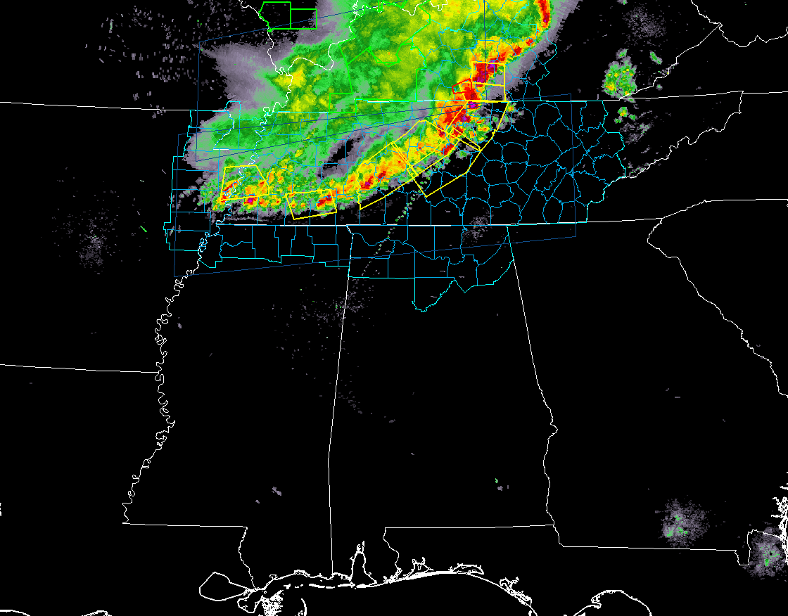
Strong to severe thunderstorms associated with an MCS is moving southeastward through the western half of Tennessee and the central parts of Kentucky at 8:08 PM and should be crossing the AL/TN state line and affecting the northwestern parts of North Alabama within the next 30-60 minutes. The forward speed at this point is at 30 MPH.
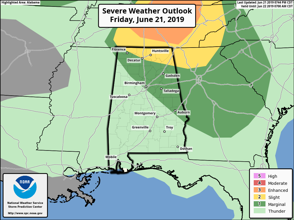
A Slight Risk is now up for the extreme northern parts of North Alabama with a Marginal Risk up for the rest of North Alabama and a good portion of the northeastern half of Central Alabama.
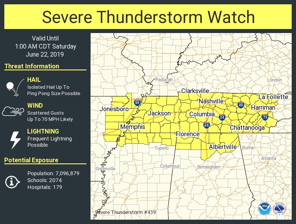
A Severe Thunderstorm Watch is already in effect for all of the North Alabama counties until 1:00 am Saturday. We’ll have to see if the MCS will maintain enough strength to issue a watch for Central Alabama a little later tonight.
Category: Alabama's Weather, ALL POSTS, Severe Weather
About the Author (Author Profile)
Scott Martin is an operational meteorologist, professional graphic artist, musician, husband, and father. Not only is Scott a member of the National Weather Association, but he is also the Central Alabama Chapter of the NWA president. Scott is also the co-founder of Racecast Weather, which provides forecasts for many racing series across the USA. He also supplies forecasts for the BassMaster Elite Series events including the BassMaster Classic.Subscribe
If you enjoyed this article, subscribe to receive more just like it.


