Alabama Weather Update Just After 5 p.m.
Showers and storms continue across Alabama at this hour.
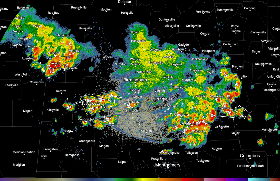
There are three man concentrations now:
1. From south of Oxford in East Alabama to southwest of Dadeville, affecting places like Dadeville, Alex City, New Site, Ashland, and Lineville. Clay County has a severe thunderstorm warning. Trees were reported down around Lineville and Ashland.
2. Over West Alabama’s Pickens and Tuscaloosa Counties. Storms are severe in the Tuscaloosa area, where severe thunderstorm warning is in effect for Tuscaloosa County. Quarter-sized hail was reported near Flatwoods in Tuscaloosa County. Dime sized hail was just reported west of Vernon.
3. Intense storms are over Lamar, Fayette and Marion Counties. These storms will move east southeastward toward Walker, northern Tuscaloosa, and western Jefferson County.
Other reports;
…Several reports of nickel-sized hail from Shelby County from earlier storms.
…Numerous reports of wind damage from Blount County including trees down. A barn lost its roof near Altoona in Etowah County.
…Trees were reported down near Corner in northern Jefferson County.
Category: Alabama's Weather, ALL POSTS
About the Author (Author Profile)
Bill Murray is the President of The Weather Factory. He is the site's official weather historian and a weekend forecaster. He also anchors the site's severe weather coverage. Bill Murray is the proud holder of National Weather Association Digital Seal #0001 @wxhistorianSubscribe
If you enjoyed this article, subscribe to receive more just like it.


