A Brunch Time Look at Alabama’s Weather
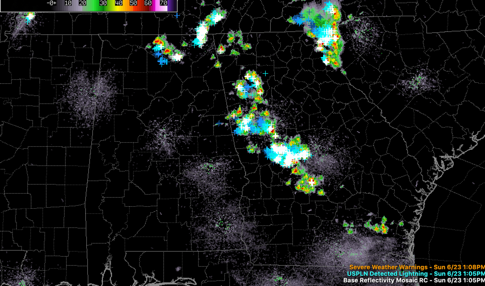
Showers and storms have started to form this afternoon over North and Northeast Alabama.
There is a good bit of lightning now showing up over Limestone, Madison, Morgan, and Jackson Counties.
These storms will drift east into Georgia over the next three hours.
Elsewhere, a few isolated storms will form over the rest of Alabama this afternoon. Ones that do form could be strong to severe with heavy rain, winds to 60 mph and deadly lightning.
The 3km NAM model has had a good handle on the development so far, so it may be right that a complex of storms will form over Central Mississippi and move into West Alabama after 6 p.m. It weakens these storms before they reach Birmingham, but they could hold together long enough to reach the Magic City. Certainly Tuscaloosa. Be alert for those storms later.
A weakening band of showers will move into West Alabama early tomorrow morning, but it should fall apart before reaching I-59.
Additional showers and storms will form during the early afternoon and push through the I-59 Corridor during the afternoon. Some of those storms will be strong.
A frontal system will be far enough south to keep Tuesday’s showers and storms down around Montgomery and points south.
We will be tracking additional development through the afternoon.
Category: Alabama's Weather, ALL POSTS
About the Author (Author Profile)
Bill Murray is the President of The Weather Factory. He is the site's official weather historian and a weekend forecaster. He also anchors the site's severe weather coverage. Bill Murray is the proud holder of National Weather Association Digital Seal #0001 @wxhistorianSubscribe
If you enjoyed this article, subscribe to receive more just like it.


