Storms Will Approach Northwest Corner of the State Around Midnight
Storms have intensified over Northeast Mississippi tonight and are aimed at the Northwest Corner of our state.
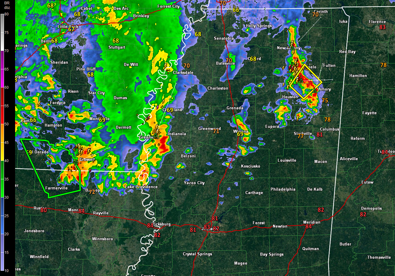
The storms approaching Okolona and Tupelo are severe, with a severe thunderstorm warning for Chickasaw, Lee, Monroe, and Pontotoc. Doppler radar is picking up winds of nearly 60 mph.
They also have lots of lightning and could very well have small hail. Heavy rain is also an issue.
Additional storms extend from near Greenville along the Mississippi River, back into northern Louisiana and southern Arkansas. These storms may reach the Northwest Corner of Alabama around 5-6 a.m., but they should be much weaker by then.
The large mass of rain behind this activity will probably fall apart before making it deep into Alabama as well.
The lead disturbance responsible for the thunderstorms tonight over the Magnolia State will shift northeastward tomorrow morning, but a trailing disturbance will likely trigger another round of showers and storms by afternoon. This activity should be focused over areas east of I-59. There will be a risk of severe weather in this area. The greatest threat will be damaging winds and large hail. The threat window is between noon and 10 p.m.
Category: Alabama's Weather, ALL POSTS
About the Author (Author Profile)
Bill Murray is the President of The Weather Factory. He is the site's official weather historian and a weekend forecaster. He also anchors the site's severe weather coverage. Bill Murray is the proud holder of National Weather Association Digital Seal #0001 @wxhistorianSubscribe
If you enjoyed this article, subscribe to receive more just like it.


