Stronger Storms Already Out There As We Approach Midday
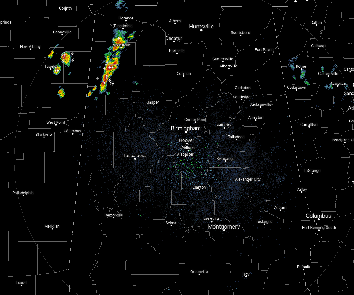
At 11:15 am, we have a cluster of storms moving across the northwestern parts of North/Central Alabama that are putting down very heavy rain, plenty of cloud-to-ground lightning, pea size hail, and strong winds up to and exceeding 40 MPH. These storms are drifting to the south-southeast very slowly.
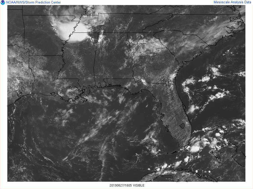
The rest of the area is dry with mainly sunny skies. Temperatures at this point are in the lower 80s to the lower 90s across the area with Tuscaloosa leading the charge at 90 degrees. Birmingham was at 88 degrees, while the cool spot was Anniston at 81 degrees.
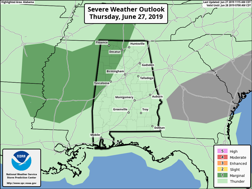
We’ll continue to see more showers and thunderstorms develop through the afternoon and into the early evening hours, mainly across the western half of Central Alabama. Some could be strong to severe, especially over the west and northwestern parts of the area. SPC has a Marginal Risk for severe storms up for locations west of a line from Jasper to Tuscaloosa to Livingston. Afternoon highs will be in the lower to mid-90s across the area. We’ll continue to have a chance of isolated to scattered showers and storms during the evening and into the late night hours. Lows will be in the mid-60s to the lower 70s.
Another typical summertime day for Central Alabama on Friday… We’ll have a mix of sun and clouds with a chance of isolated to scattered showers and thunderstorms mainly during the afternoon and early evening hours and mostly over the western half of the area. Highs will be in the upper 80s to the lower 90s across the area.
TROPICS: A quiet Atlantic Hurricane Season continues for the next five days as no tropical cyclones are expected to form over the next five days.
BEACH FORECAST CENTER: Get the latest weather and rip current forecasts for the beaches from Fort Morgan to Panama City on our Beach Forecast Center page. There, you can select the forecast of the region that you are interested in.
ALREADY OFF TO A HOT START IN 2019! ADVERTISE WITH THE BLOG!: We have enjoyed over 10 MILLION page views on AlabamaWx.com so far in 2019! Don’t miss out! We can customize a creative, flexible and affordable package that will suit your organization’s needs. Contact Bill Murray at (205) 687-0782.
E-FORECAST: Get the Alabama Wx Weather Blog’s Seven-Day Forecast delivered directly to your inbox by email twice daily. It is the most detailed weather forecast available in Central Alabama. Subscribe here… It’s free!
CONNECT WITH THE BLOG ON SOCIAL MEDIA: You can find the AlabamaWx Weather Blog on the major social media networks:
Facebook
Twitter
Instagram
WEATHERBRAINS: Don’t forget you can listen to our weekly 90 minute netcast anytime on the web at WeatherBrains.com or on iTunes, Stitcher, or Spotify. This is the show all about weather featuring many familiar voices, including the meteorologists at ABC 33/40.
Category: Alabama's Weather, ALL POSTS
About the Author (Author Profile)
Scott Martin is an operational meteorologist, professional graphic artist, musician, husband, and father. Not only is Scott a member of the National Weather Association, but he is also the Central Alabama Chapter of the NWA president. Scott is also the co-founder of Racecast Weather, which provides forecasts for many racing series across the USA. He also supplies forecasts for the BassMaster Elite Series events including the BassMaster Classic.Subscribe
If you enjoyed this article, subscribe to receive more just like it.


