

Mainly Sunny Skies & Warming Up At Midday
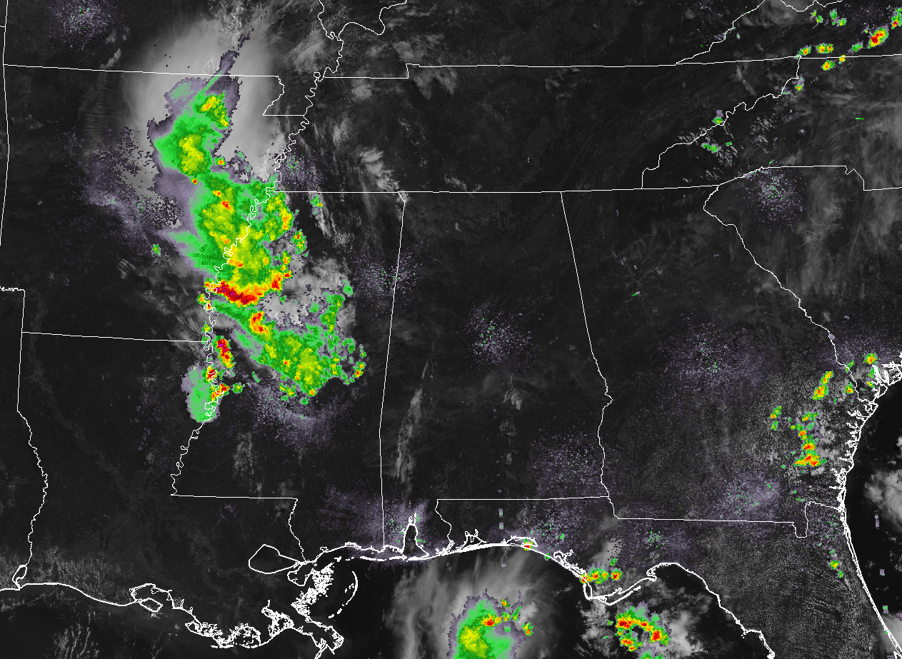
At 11:25 am, we have a clean sweep on radar at this point across Central Alabama with the closest thunderstorm activity pushing south-southeastward through much of west and central Mississippi. As a matter of fact, we have very little in the way of clouds across our skies. Temperatures are in the lower 80s to right at 90 degrees from north to south across the area. Birmingham is at 88 degrees, while several locations are tied at 82 degrees as the cool spots. Montgomery is currently at 90 degrees as the hot spot.
Clouds are expected to build somewhat during the day making the skies partly cloudy, and with the heating of the day, we should start to see those scattered showers and thunderstorms pop up. The higher chances of those will be over the western half of the area, while there will be a very small chance over the far eastern locations. Afternoon highs will be in the upper 80s to the lower 90s. We could continue to see a few lingering showers and thunderstorms during the evening and late night hours, but those will be dissipating in coverage and should eventually be gone before we cross over the midnight hour. Higher chances will be in the southwestern parts of the area. Lows will be in the upper 60s to the lower 70s.
Not expecting a big change in the forecast for Saturday as we’ll continue to have hot and humid conditions across Central Alabama. A good bit of sun early, but will become partly cloudy by the afternoon with a chance of those scattered summertime showers and thunderstorms. Highs will once again be in the upper 80s to the lower 90s.
TROPICS: A quiet Atlantic Hurricane Season continues for the next five days as no tropical cyclones are expected to form.
BEACH FORECAST CENTER: Get the latest weather and rip current forecasts for the beaches from Fort Morgan to Panama City on our Beach Forecast Center page. There, you can select the forecast of the region that you are interested in.
ALREADY OFF TO A HOT START IN 2019! ADVERTISE WITH THE BLOG!: We have enjoyed over 10 MILLION page views on AlabamaWx.com so far in 2019! Don’t miss out! We can customize a creative, flexible and affordable package that will suit your organization’s needs. Contact Bill Murray at (205) 687-0782.
E-FORECAST: Get the Alabama Wx Weather Blog’s Seven-Day Forecast delivered directly to your inbox by email twice daily. It is the most detailed weather forecast available in Central Alabama. Subscribe here… It’s free!
CONNECT WITH THE BLOG ON SOCIAL MEDIA: You can find the AlabamaWx Weather Blog on the major social media networks:
Facebook
Twitter
Instagram
WEATHERBRAINS: Don’t forget you can listen to our weekly 90 minute netcast anytime on the web at WeatherBrains.com or on iTunes, Stitcher, or Spotify. This is the show all about weather featuring many familiar voices, including the meteorologists at ABC 33/40.
Category: Alabama's Weather, ALL POSTS
About the Author (Author Profile)
Scott Martin is an operational meteorologist, professional graphic artist, musician, husband, and father. Not only is Scott a member of the National Weather Association, but he is also the Central Alabama Chapter of the NWA president. Scott is also the co-founder of Racecast Weather, which provides forecasts for many racing series across the USA. He also supplies forecasts for the BassMaster Elite Series events including the BassMaster Classic.Subscribe
If you enjoyed this article, subscribe to receive more just like it.


