Scattered Showers & Storms Providing Nature’s Fireworks At Midday
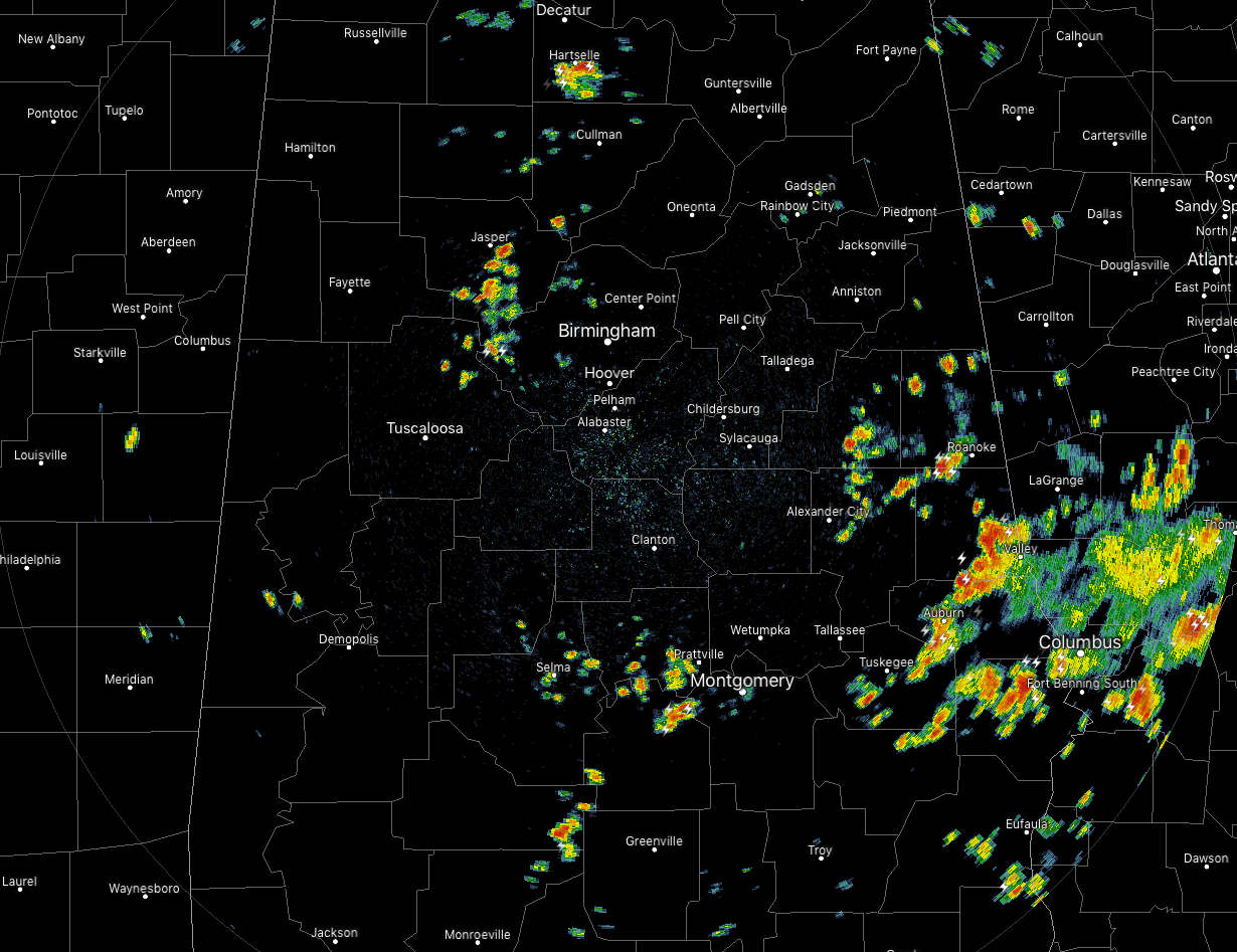
At 1:20 pm, radar shows several clusters of scattered showers and thunderstorms over portions of Central Alabama, with the largest cluster concentrated over the southeastern parts of the area. We also have smaller clusters moving into the western parts of Jefferson County and another moving into the western parts of Montgomery County. All of these storms are slowly drifting to the east.
For the rest of the afternoon and into the early evening hours, We will continue to see scattered showers and thunderstorms develop across portions of Central Alabama. Wherever it is dry, skies will be partly to mostly clear. Afternoon highs will top out in the lower to mid-90s with heat index values reaching the 99-103 degree range.
For this evening and into the nighttime hours for the fireworks show at Red Mountain, there will be a small chance of a few showers and thunderstorms, but hopefully, most of those will dissipate by the time the first rocket is launched into the sky. Temperatures will be in the lower to mid-80s across the area by 8:00 pm, and eventually, drop into the lower to mid-70s for the overnight lows.
Friday will see an uptick in shower and thunderstorm chances as more moisture will be pumped up into Central Alabama. We’ll have partly to mostly cloudy skies across the area with scattered to numerous showers and thunderstorms possible across much of the area, while likely in the extreme eastern parts of the area. Highs will be in the lower to mid-90s.
Category: Alabama's Weather, ALL POSTS
About the Author (Author Profile)
Scott Martin is an operational meteorologist, professional graphic artist, musician, husband, and father. Not only is Scott a member of the National Weather Association, but he is also the Central Alabama Chapter of the NWA president. Scott is also the co-founder of Racecast Weather, which provides forecasts for many racing series across the USA. He also supplies forecasts for the BassMaster Elite Series events including the BassMaster Classic.Subscribe
If you enjoyed this article, subscribe to receive more just like it.


