Showers/Storms To Increase In Coming Days
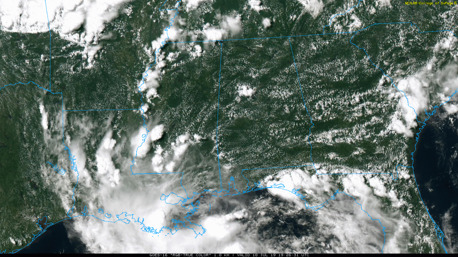
RADAR CHECK: Showers and thunderstorms are increasing across Central Alabama this afternoon… they are moving to the west, thanks to the tropical cyclonic circulation in the northern Gulf of Mexico. The storms are producing heavy rain, gusty winds, and lots of lightning, and we will hang on to the chance of scattered storms through tonight.
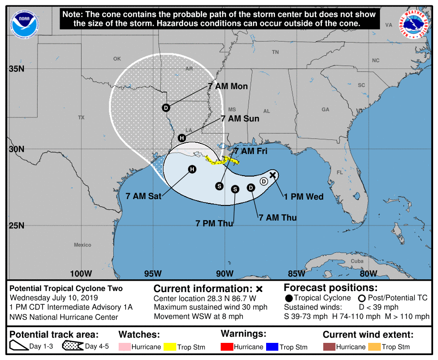
EYES ON THE GULF: A tropical storm, which will be named Barry, is expected to form in the northern Gulf of Mexico tonight or tomorrow. For now, NHC has it designated “Potential Tropical Cyclone Two”. It will move westward, and then curve up to the Louisiana coast where it is expected to make landfall Saturday as a category one hurricane.
Needless to say, this will have a big impact on coastal and inland weather across the Southeast U.S. in coming days.
GULF COAST: A Storm Surge Watch is in effect from the mouth of the Pearl River to Intracoastal City. A Hurricane Watch is in effect from the mouth of the Mississippi River to Cameron, Louisiana. And, a Tropical Storm Watch is in effect from the mouth of the Mississippi River northward to the mouth of the Pearl River. The main storm surge threat and wind threat will be along this segment of the Louisiana coast Friday night and Saturday as Barry approaches.
For the area from Dauphin Island to Gulf Shores to Destin to Panama City Beach, understand tropical bands of heavy rain are likely from time to time tomorrow through Sunday. These bands will be established far east of the center of circulation. When they come through heavy rain is likely, and an isolated brief waterspout or tornado is possible. Also, dangerous rip currents are likely tomorrow, Friday, and over the weekend, and expect double red flags to be flying.
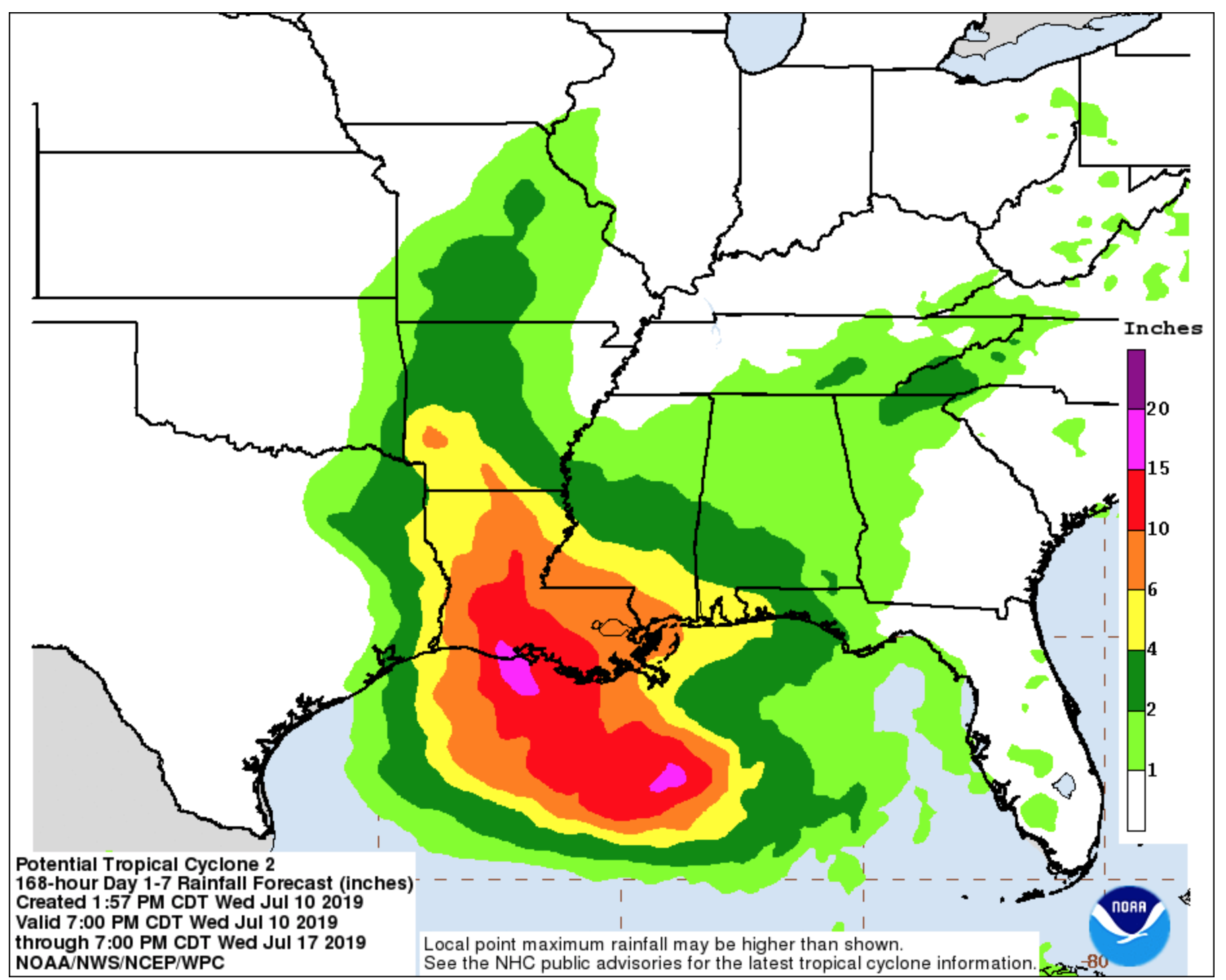
Rain amounts of 4-6 inches are likely tomorrow through Sunday for Mobile and Baldwin counties in Alabama, and over to Pensacola. A flash flood watch has been issued. Amounts of 2-4 inches are expected at Destin and Panama City Beach.
Heaviest rain will come over parts of coastal Mississippi and much of South Louisiana, where over 10 inches is likely.
On the positive side, there will be some good breaks in the rain, and you will see the sun at times on the coasts of Alabama and Northwest Florida in coming days.
The weather on the coast will trend drier and the seas should be calmer by Tuesday and Wednesday of next week.
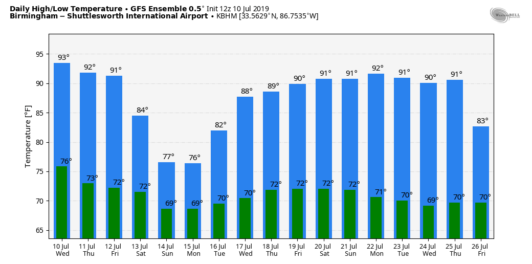
INLAND PARTS OF ALABAMA: Tomorrow will be another hot, muggy day, but showers and storms should be more numerous during the afternoon hours as moisture levels rise. The high will be close to 90.
Then, Friday though Sunday, the weather will be unsettled with occasional showers and thunderstorms each day. The amount of rain we receive will depend on the ultimate northward track of Barry, but much of the state will see at least 1 to 2 inches, with potential for up to 4 inches in spots. For now severe storms are not expected, but with Barry to the west we might have a day with a low end tornado threat (probably Sunday). Like the coast, we will see some nice breaks in the rain, and the sun will break out occasionally.
Heat levels will trend downward with highs in the 80s Friday and Saturday. Some places will hold in the 70s Sunday because of clouds and rain.
NEXT WEEK: Scattered to numerous showers and storms remain possible Monday, then we trend drier toward the middle of the week as the remnant circulation of Barry is swept away in the mid latitude westerlies. See the Weather Xtreme video for maps, graphics, and more details.
ON THIS DATE IN 2005: Hurricane Dennis made landfall over Santa Rosa Island, Florida on July 10 as a Category 3. Prior to landfall, the hurricane reached Category 4 strength as it approached Florida, attaining its lowest barometric pressure of 930 mb. This ranked Dennis as the strongest hurricane in the Atlantic basin to form before August; however, this record was broken just six days later by Hurricane Emily, which surpassed Dennis and attained Category 5 status. In Alabama, sustained winds reached minimal hurricane force in the interior of the state. In all, 280,000 people in Alabama experienced power outages during the storm.
BEACH FORECAST: Click here to see the AlabamaWx Beach Forecast Center page.
WEATHER BRAINS: Don’t forget you can listen to our weekly 90 minute show anytime on your favorite podcast app. This is the show all about weather featuring many familiar voices, including our meteorologists here at ABC 33/40.
CONNECT: You can find me on all of the major social networks…
Facebook
Twitter
Instagram
Pinterest
Snapchat: spannwx
Look for the next Weather Xtreme video here by 7:00 a.m. tomorrow…
Category: ALL POSTS
About the Author (Author Profile)
James Spann is one of the most recognized and trusted television meteorologists in the industry. He holds the AMS CCM designation and television seals from the AMS and NWA. He is a past winner of the Broadcast Meteorologist of the Year from both professional organizations.Subscribe
If you enjoyed this article, subscribe to receive more just like it.


