Radar Check at 4 p.m.: Storms Over North Central Alabama
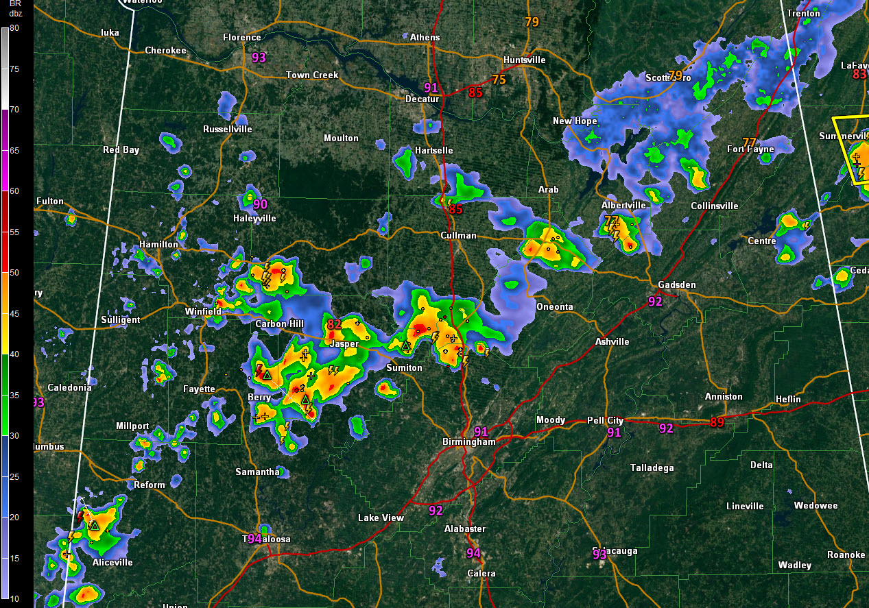
Thunderstorms are occurring this afternoon across West Central, North Central, and North East Alabama. They are being caused by an area of convergence from a trough moving through the Mid-Atlantic states and by higher moisture levels to the northwest.
The strongest storms are over Winston,eastern Fayette, southern Cullman, and northern Jefferson Counties.
The cells are drifting slowly southeastward.
There have lots of heavy rain, some gusty winds, and dangerous lightning.
Be inside when these storms are in your area.
The new advisory is out on Tropical Storm Barry. Hurricane warnings have been issued for positions of the Louisiana coast. Top winds are still 40 mph in the disorganized storm. It is expected to become a hurricane before making landfall over southern Louisiana late Friday night or early Saturday.
We will have an update on the storm shortly.
Category: Alabama's Weather, ALL POSTS
About the Author (Author Profile)
Bill Murray is the President of The Weather Factory. He is the site's official weather historian and a weekend forecaster. He also anchors the site's severe weather coverage. Bill Murray is the proud holder of National Weather Association Digital Seal #0001 @wxhistorianSubscribe
If you enjoyed this article, subscribe to receive more just like it.


